You are here: Home > Network List > II - Global Seismograph Network (GSN - IRIS/IDA) Stations List
> Station TAU Hobart, Tasmania, Australia > Earthquake Result Viewer
TAU Hobart, Tasmania, Australia - Earthquake Result Viewer

| Earthquake location: |
Solomon Islands |
| Earthquake latitude/longitude: |
-7.9/158.6 |
| Earthquake time(UTC): |
1998/11/25 (329) 18:05:25 GMT |
| Earthquake Depth: |
48 km |
| Earthquake Magnitude: |
5.9 MB, 6.0 MS, 6.2 UNKNOWN, 6.2 MW |
| Earthquake Catalog/Contributor: |
WHDF/NEIC |
|
| Network: |
II Global Seismograph Network (GSN - IRIS/IDA) |
| Station: |
TAU Hobart, Tasmania, Australia |
| Lat/Lon: |
42.91 S/147.32 E |
| Elevation: |
132 m |
|
| Distance: |
36.3 deg |
| Az: |
194.076 deg |
| Baz: |
19.145 deg |
| Ray Param: |
0.07663799 |
| Estimated Moho Depth: |
57.25 km |
| Estimated Crust Vp/Vs: |
1.68 |
| Assumed Crust Vp: |
6.477 km/s |
| Estimated Crust Vs: |
3.855 km/s |
| Estimated Crust Poisson's Ratio: |
0.23 |
|
| Radial Match: |
90.13773 % |
| Radial Bump: |
374 |
| Transverse Match: |
73.32321 % |
| Transverse Bump: |
400 |
| SOD ConfigId: |
4480 |
| Insert Time: |
2010-03-02 00:35:04.986 +0000 |
| GWidth: |
2.5 |
| Max Bumps: |
400 |
| Tol: |
0.001 |
|
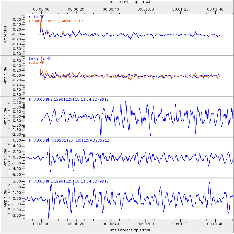
Signal To Noise
| Channel | StoN | STA | LTA |
| II:TAU:00:BHN:19981125T18:11:54.327991Z | 7.9259524 | 2.14943E-6 | 2.7118887E-7 |
| II:TAU:00:BHE:19981125T18:11:54.327991Z | 5.8007803 | 1.1292641E-6 | 1.9467453E-7 |
| II:TAU:00:BHZ:19981125T18:11:54.327991Z | 1.9215491 | 6.878368E-7 | 3.5795952E-7 |
| Arrivals |
| Ps | 6.5 SECOND |
| PpPs | 22 SECOND |
| PsPs/PpSs | 28 SECOND |


