You are here: Home > Network List > US - United States National Seismic Network Stations List
> Station DGMT Dagmar, Montana, USA > Earthquake Result Viewer
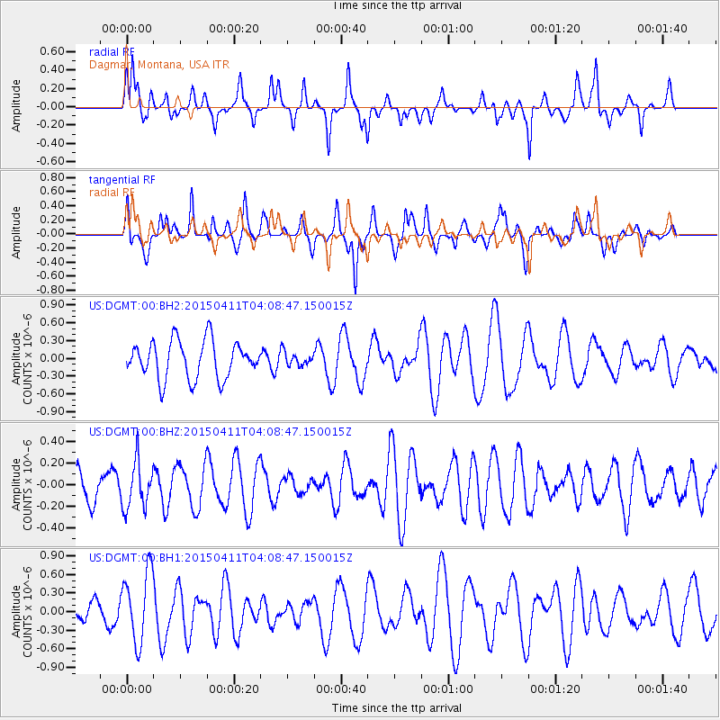
DGMT Dagmar, Montana, USA - Earthquake Result Viewer
*The percent match for this event was below the threshold and hence no stack was calculated.
| Earthquake location: |
Northwest Of Kuril Islands |
| Earthquake latitude/longitude: |
52.0/153.2 |
| Earthquake time(UTC): |
2015/04/11 (101) 03:59:53 GMT |
| Earthquake Depth: |
433 km |
| Earthquake Magnitude: |
4.7 mb, 4.7 mb |
| Earthquake Catalog/Contributor: |
ISC/ISC |
|
| Network: |
US United States National Seismic Network |
| Station: |
DGMT Dagmar, Montana, USA |
| Lat/Lon: |
48.47 N/104.20 W |
| Elevation: |
0.0 m |
|
| Distance: |
60.2 deg |
| Az: |
48.468 deg |
| Baz: |
315.992 deg |
| Ray Param: |
$rayparam |
*The percent match for this event was below the threshold and hence was not used in the summary stack. |
|
| Radial Match: |
51.69604 % |
| Radial Bump: |
369 |
| Transverse Match: |
54.547123 % |
| Transverse Bump: |
400 |
| SOD ConfigId: |
7422571 |
| Insert Time: |
2019-04-18 03:45:33.278 +0000 |
| GWidth: |
2.5 |
| Max Bumps: |
400 |
| Tol: |
0.001 |
|
Signal To Noise
| Channel | StoN | STA | LTA |
| US:DGMT:00:BHZ:20150411T04:08:47.150015Z | 1.4285282 | 2.1703111E-7 | 1.5192639E-7 |
| US:DGMT:00:BH1:20150411T04:08:47.150015Z | 2.1833265 | 5.790034E-7 | 2.6519325E-7 |
| US:DGMT:00:BH2:20150411T04:08:47.150015Z | 0.34418988 | 1.0915317E-7 | 3.1713068E-7 |
| Arrivals |
| Ps | |
| PpPs | |
| PsPs/PpSs | |


