
TAU Hobart, Tasmania, Australia - Earthquake Result Viewer
| ||||||||||||||||||
| ||||||||||||||||||
| ||||||||||||||||||
|
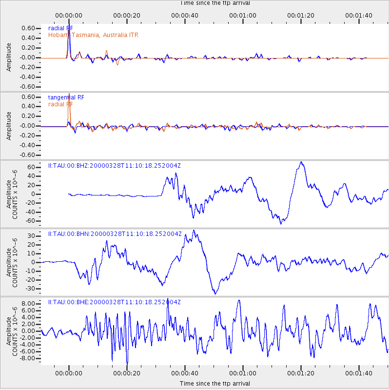
Signal To Noise
| Channel | StoN | STA | LTA |
| II:TAU:00:BHN:20000328T11:10:18.252004Z | 10.659781 | 8.496313E-6 | 7.970438E-7 |
| II:TAU:00:BHE:20000328T11:10:18.252004Z | 1.4831668 | 8.563707E-7 | 5.773934E-7 |
| II:TAU:00:BHZ:20000328T11:10:18.252004Z | 15.236716 | 1.9292254E-5 | 1.2661687E-6 |
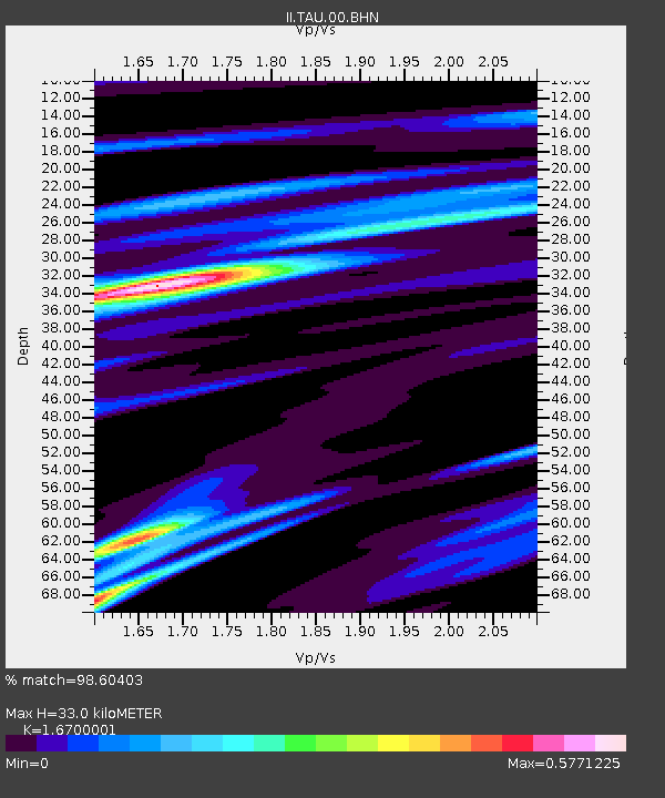
| Arrivals | |
| Ps | 3.6 SECOND |
| PpPs | 13 SECOND |
| PsPs/PpSs | 17 SECOND |

