TAU Hobart, Tasmania, Australia - Earthquake Result Viewer
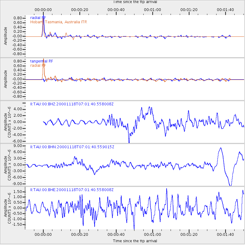
Earthquake location: New Britain Region, P.N.G.
Earthquake latitude/longitude: -5.2/151.8
Earthquake time(UTC): 2000/11/18 (323) 06:54:58 GMT
Earthquake Depth: 33 km
Earthquake Magnitude: 6.2 MB, 6.6 MS, 6.8 MW, 6.8 MW
Earthquake Catalog/Contributor: WHDF/NEIC
Network: II Global Seismograph Network (GSN - IRIS/IDA)
Station: TAU Hobart, Tasmania, Australia
Lat/Lon: 42.91 S/147.32 E
Elevation: 132 m
Distance: 37.7 deg
Az: 185.346 deg
Baz: 7.255 deg
Ray Param: 0.07590621
Estimated Moho Depth: 49.5 km
Estimated Crust Vp/Vs: 1.79
Assumed Crust Vp: 6.477 km/s
Estimated Crust Vs: 3.613 km/s
Estimated Crust Poisson's Ratio: 0.27
Radial Match: 95.230064 %
Radial Bump: 378
Transverse Match: 54.351826 %
Transverse Bump: 400
SOD ConfigId: 3744
Insert Time: 2010-03-02 00:35:30.497 +0000
GWidth: 2.5
Max Bumps: 400
Tol: 0.001

Signal To Noise

ChannelStoNSTALTA
II:TAU:00:BHN:20001118T07:01:40.559015Z0.68480223.6383554E-75.313002E-7
II:TAU:00:BHE:20001118T07:01:40.558008Z0.78876473.6356207E-74.6092586E-7
II:TAU:00:BHZ:20001118T07:01:40.558008Z1.07513375.794969E-75.389998E-7
Arrivals
Ps6.5 SECOND
PpPs20 SECOND
PsPs/PpSs26 SECOND