TAU Hobart, Tasmania, Australia - Earthquake Result Viewer
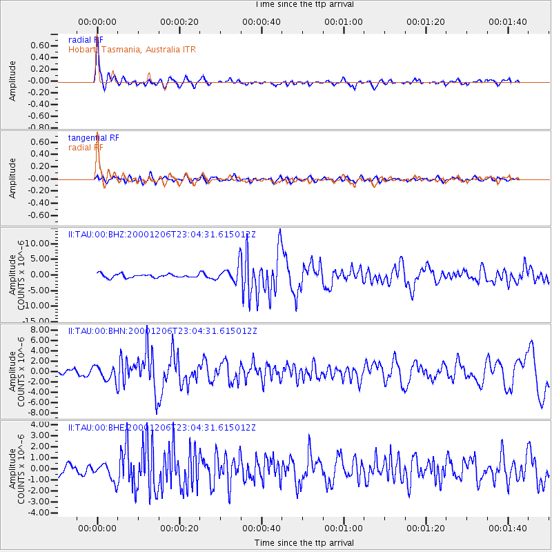
Earthquake location: New Britain Region, P.N.G.
Earthquake latitude/longitude: -4.2/152.7
Earthquake time(UTC): 2000/12/06 (341) 22:57:40 GMT
Earthquake Depth: 31 km
Earthquake Magnitude: 6.1 MB, 6.6 MS, 6.6 MW, 6.2 ME
Earthquake Catalog/Contributor: WHDF/NEIC
Network: II Global Seismograph Network (GSN - IRIS/IDA)
Station: TAU Hobart, Tasmania, Australia
Lat/Lon: 42.91 S/147.32 E
Elevation: 132 m
Distance: 38.8 deg
Az: 186.337 deg
Baz: 8.617 deg
Ray Param: 0.07527958
Estimated Moho Depth: 42.5 km
Estimated Crust Vp/Vs: 1.88
Assumed Crust Vp: 6.477 km/s
Estimated Crust Vs: 3.454 km/s
Estimated Crust Poisson's Ratio: 0.30
Radial Match: 82.57967 %
Radial Bump: 400
Transverse Match: 59.34686 %
Transverse Bump: 400
SOD ConfigId: 3744
Insert Time: 2010-03-02 00:35:40.692 +0000
GWidth: 2.5
Max Bumps: 400
Tol: 0.001

Signal To Noise

ChannelStoNSTALTA
II:TAU:00:BHN:20001206T23:04:31.615012Z2.43463091.4957011E-66.1434406E-7
II:TAU:00:BHE:20001206T23:04:31.615012Z1.78126178.263653E-74.6392134E-7
II:TAU:00:BHZ:20001206T23:04:31.615012Z4.95923572.81369E-65.673636E-7
Arrivals
Ps6.2 SECOND
PpPs18 SECOND
PsPs/PpSs24 SECOND