TAU Hobart, Tasmania, Australia - Earthquake Result Viewer
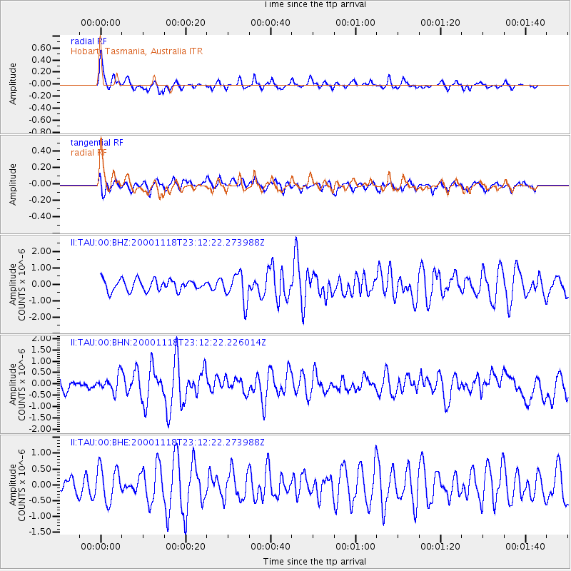
Earthquake location: New Ireland Region, P.N.G.
Earthquake latitude/longitude: -5.4/153.5
Earthquake time(UTC): 2000/11/18 (323) 23:05:39 GMT
Earthquake Depth: 33 km
Earthquake Magnitude: 5.7 MB, 6.0 MS, 6.0 MW, 5.9 MW
Earthquake Catalog/Contributor: WHDF/NEIC
Network: II Global Seismograph Network (GSN - IRIS/IDA)
Station: TAU Hobart, Tasmania, Australia
Lat/Lon: 42.91 S/147.32 E
Elevation: 132 m
Distance: 37.8 deg
Az: 187.362 deg
Baz: 10.001 deg
Ray Param: 0.07588807
Estimated Moho Depth: 34.75 km
Estimated Crust Vp/Vs: 1.60
Assumed Crust Vp: 6.477 km/s
Estimated Crust Vs: 4.048 km/s
Estimated Crust Poisson's Ratio: 0.18
Radial Match: 82.78732 %
Radial Bump: 330
Transverse Match: 53.5796 %
Transverse Bump: 400
SOD ConfigId: 3744
Insert Time: 2010-03-02 00:35:42.088 +0000
GWidth: 2.5
Max Bumps: 400
Tol: 0.001

Signal To Noise

ChannelStoNSTALTA
II:TAU:00:BHN:20001118T23:12:22.226014Z1.42176493.7078493E-72.6079204E-7
II:TAU:00:BHE:20001118T23:12:22.273988Z1.82961085.4811073E-72.9957778E-7
II:TAU:00:BHZ:20001118T23:12:22.273988Z2.6256968.838536E-73.3661686E-7
Arrivals
Ps3.5 SECOND
PpPs13 SECOND
PsPs/PpSs16 SECOND