You are here: Home > Network List > GS - US Geological Survey Networks Stations List
> Station KAN10 Keim Farm > Earthquake Result Viewer
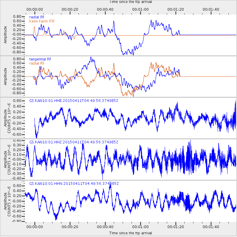
KAN10 Keim Farm - Earthquake Result Viewer
*The percent match for this event was below the threshold and hence no stack was calculated.
| Earthquake location: |
Kuril Islands |
| Earthquake latitude/longitude: |
44.0/146.9 |
| Earthquake time(UTC): |
2015/04/11 (101) 04:38:30 GMT |
| Earthquake Depth: |
117 km |
| Earthquake Magnitude: |
3.7 mb |
| Earthquake Catalog/Contributor: |
ISC/ISC |
|
| Network: |
GS US Geological Survey Networks |
| Station: |
KAN10 Keim Farm |
| Lat/Lon: |
37.12 N/98.10 W |
| Elevation: |
417 m |
|
| Distance: |
80.1 deg |
| Az: |
47.329 deg |
| Baz: |
318.442 deg |
| Ray Param: |
$rayparam |
*The percent match for this event was below the threshold and hence was not used in the summary stack. |
|
| Radial Match: |
49.64078 % |
| Radial Bump: |
400 |
| Transverse Match: |
62.966255 % |
| Transverse Bump: |
400 |
| SOD ConfigId: |
7422571 |
| Insert Time: |
2019-04-18 03:50:05.171 +0000 |
| GWidth: |
2.5 |
| Max Bumps: |
400 |
| Tol: |
0.001 |
|
Signal To Noise
| Channel | StoN | STA | LTA |
| GS:KAN10:01:HHZ:20150411T04:49:56.374985Z | 0.76385564 | 1.1414109E-7 | 1.4942758E-7 |
| GS:KAN10:01:HHN:20150411T04:49:56.374985Z | 0.9703985 | 2.821077E-7 | 2.9071325E-7 |
| GS:KAN10:01:HHE:20150411T04:49:56.374985Z | 0.6642286 | 1.4165711E-7 | 2.132656E-7 |
| Arrivals |
| Ps | |
| PpPs | |
| PsPs/PpSs | |


