You are here: Home > Network List > TA - USArray Transportable Network (new EarthScope stations) Stations List
> Station I23K Minto, Yukon-Koyukuk, AK, USA > Earthquake Result Viewer
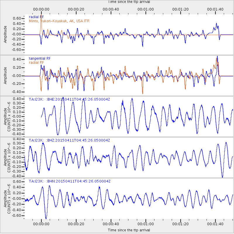
I23K Minto, Yukon-Koyukuk, AK, USA - Earthquake Result Viewer
*The percent match for this event was below the threshold and hence no stack was calculated.
| Earthquake location: |
Kuril Islands |
| Earthquake latitude/longitude: |
44.0/146.9 |
| Earthquake time(UTC): |
2015/04/11 (101) 04:38:30 GMT |
| Earthquake Depth: |
117 km |
| Earthquake Magnitude: |
3.7 mb |
| Earthquake Catalog/Contributor: |
ISC/ISC |
|
| Network: |
TA USArray Transportable Network (new EarthScope stations) |
| Station: |
I23K Minto, Yukon-Koyukuk, AK, USA |
| Lat/Lon: |
65.15 N/149.36 W |
| Elevation: |
149 m |
|
| Distance: |
40.3 deg |
| Az: |
35.875 deg |
| Baz: |
270.339 deg |
| Ray Param: |
$rayparam |
*The percent match for this event was below the threshold and hence was not used in the summary stack. |
|
| Radial Match: |
48.00033 % |
| Radial Bump: |
400 |
| Transverse Match: |
52.59275 % |
| Transverse Bump: |
373 |
| SOD ConfigId: |
7422571 |
| Insert Time: |
2019-04-18 03:52:41.976 +0000 |
| GWidth: |
2.5 |
| Max Bumps: |
400 |
| Tol: |
0.001 |
|
Signal To Noise
| Channel | StoN | STA | LTA |
| TA:I23K: :BHZ:20150411T04:45:26.050004Z | 2.1011143 | 2.1531564E-7 | 1.0247688E-7 |
| TA:I23K: :BHN:20150411T04:45:26.050004Z | 3.6393292 | 3.9031193E-7 | 1.0724832E-7 |
| TA:I23K: :BHE:20150411T04:45:26.050004Z | 0.40833768 | 9.731097E-8 | 2.3831004E-7 |
| Arrivals |
| Ps | |
| PpPs | |
| PsPs/PpSs | |


