You are here: Home > Network List > TA - USArray Transportable Network (new EarthScope stations) Stations List
> Station I59A Olmsteadville, NY, USA > Earthquake Result Viewer
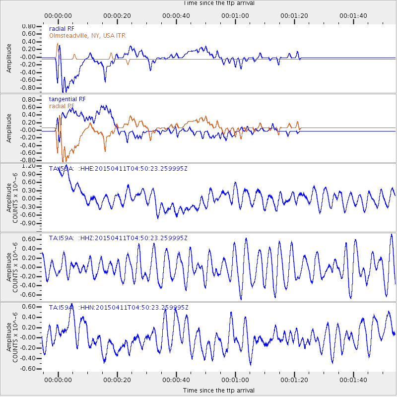
I59A Olmsteadville, NY, USA - Earthquake Result Viewer
*The percent match for this event was below the threshold and hence no stack was calculated.
| Earthquake location: |
Kuril Islands |
| Earthquake latitude/longitude: |
44.0/146.9 |
| Earthquake time(UTC): |
2015/04/11 (101) 04:38:30 GMT |
| Earthquake Depth: |
117 km |
| Earthquake Magnitude: |
3.7 mb |
| Earthquake Catalog/Contributor: |
ISC/ISC |
|
| Network: |
TA USArray Transportable Network (new EarthScope stations) |
| Station: |
I59A Olmsteadville, NY, USA |
| Lat/Lon: |
43.80 N/73.87 W |
| Elevation: |
390 m |
|
| Distance: |
85.3 deg |
| Az: |
28.315 deg |
| Baz: |
331.813 deg |
| Ray Param: |
$rayparam |
*The percent match for this event was below the threshold and hence was not used in the summary stack. |
|
| Radial Match: |
46.60694 % |
| Radial Bump: |
400 |
| Transverse Match: |
46.808933 % |
| Transverse Bump: |
400 |
| SOD ConfigId: |
7422571 |
| Insert Time: |
2019-04-18 03:52:42.982 +0000 |
| GWidth: |
2.5 |
| Max Bumps: |
400 |
| Tol: |
0.001 |
|
Signal To Noise
| Channel | StoN | STA | LTA |
| TA:I59A: :HHZ:20150411T04:50:23.259995Z | 0.66100603 | 1.7116083E-7 | 2.5893988E-7 |
| TA:I59A: :HHN:20150411T04:50:23.259995Z | 1.2071002 | 2.751675E-7 | 2.2795747E-7 |
| TA:I59A: :HHE:20150411T04:50:23.259995Z | 1.0365925 | 4.3716446E-7 | 4.217322E-7 |
| Arrivals |
| Ps | |
| PpPs | |
| PsPs/PpSs | |


