You are here: Home > Network List > II - Global Seismograph Network (GSN - IRIS/IDA) Stations List
> Station TAU Hobart, Tasmania, Australia > Earthquake Result Viewer
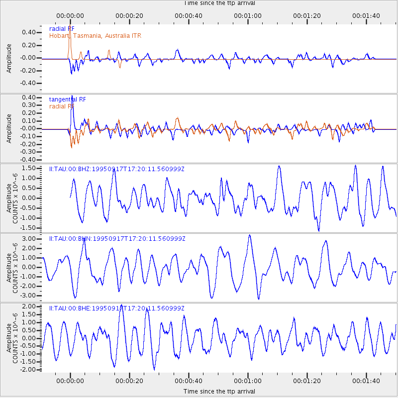
TAU Hobart, Tasmania, Australia - Earthquake Result Viewer
*The percent match for this event was below the threshold and hence no stack was calculated.
| Earthquake location: |
Mauritius - Reunion Region |
| Earthquake latitude/longitude: |
-17.2/66.6 |
| Earthquake time(UTC): |
1995/09/17 (260) 17:09:20 GMT |
| Earthquake Depth: |
10 km |
| Earthquake Magnitude: |
5.4 MB, 6.3 MS, 6.5 UNKNOWN, 6.3 MW |
| Earthquake Catalog/Contributor: |
WHDF/NEIC |
|
| Network: |
II Global Seismograph Network (GSN - IRIS/IDA) |
| Station: |
TAU Hobart, Tasmania, Australia |
| Lat/Lon: |
42.91 S/147.32 E |
| Elevation: |
132 m |
|
| Distance: |
71.7 deg |
| Az: |
130.225 deg |
| Baz: |
263.248 deg |
| Ray Param: |
$rayparam |
*The percent match for this event was below the threshold and hence was not used in the summary stack. |
|
| Radial Match: |
66.09393 % |
| Radial Bump: |
400 |
| Transverse Match: |
44.399353 % |
| Transverse Bump: |
400 |
| SOD ConfigId: |
4480 |
| Insert Time: |
2010-03-02 00:36:14.260 +0000 |
| GWidth: |
2.5 |
| Max Bumps: |
400 |
| Tol: |
0.001 |
|
Signal To Noise
| Channel | StoN | STA | LTA |
| II:TAU:00:BHN:19950917T17:20:11.560999Z | 2.484504 | 1.954187E-6 | 7.865501E-7 |
| II:TAU:00:BHE:19950917T17:20:11.560999Z | 0.9698524 | 6.375054E-7 | 6.573221E-7 |
| II:TAU:00:BHZ:19950917T17:20:11.560999Z | 0.8597713 | 5.505584E-7 | 6.403545E-7 |
| Arrivals |
| Ps | |
| PpPs | |
| PsPs/PpSs | |


