You are here: Home > Network List > US - United States National Seismic Network Stations List
> Station HAWA Hanford, Washington, USA > Earthquake Result Viewer
HAWA Hanford, Washington, USA - Earthquake Result Viewer
*The percent match for this event was below the threshold and hence no stack was calculated.
| Earthquake location: |
Kuril Islands |
| Earthquake latitude/longitude: |
44.0/146.9 |
| Earthquake time(UTC): |
2015/04/11 (101) 04:38:30 GMT |
| Earthquake Depth: |
117 km |
| Earthquake Magnitude: |
3.7 mb |
| Earthquake Catalog/Contributor: |
ISC/ISC |
|
| Network: |
US United States National Seismic Network |
| Station: |
HAWA Hanford, Washington, USA |
| Lat/Lon: |
46.39 N/119.53 W |
| Elevation: |
364 m |
|
| Distance: |
62.0 deg |
| Az: |
51.447 deg |
| Baz: |
305.432 deg |
| Ray Param: |
$rayparam |
*The percent match for this event was below the threshold and hence was not used in the summary stack. |
|
| Radial Match: |
53.465042 % |
| Radial Bump: |
400 |
| Transverse Match: |
39.028664 % |
| Transverse Bump: |
400 |
| SOD ConfigId: |
7422571 |
| Insert Time: |
2019-04-18 03:53:34.794 +0000 |
| GWidth: |
2.5 |
| Max Bumps: |
400 |
| Tol: |
0.001 |
|
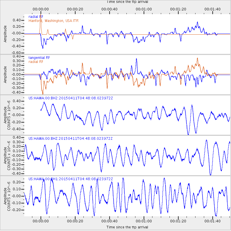
Signal To Noise
| Channel | StoN | STA | LTA |
| US:HAWA:00:BHZ:20150411T04:48:08.023972Z | 0.5602672 | 1.3039471E-7 | 2.3273662E-7 |
| US:HAWA:00:BH1:20150411T04:48:08.023972Z | 1.1918641 | 1.5732024E-7 | 1.3199511E-7 |
| US:HAWA:00:BH2:20150411T04:48:08.023972Z | 1.3743646 | 2.0922693E-7 | 1.5223539E-7 |
| Arrivals |
| Ps | |
| PpPs | |
| PsPs/PpSs | |


