You are here: Home > Network List > II - Global Seismograph Network (GSN - IRIS/IDA) Stations List
> Station TAU Hobart, Tasmania, Australia > Earthquake Result Viewer
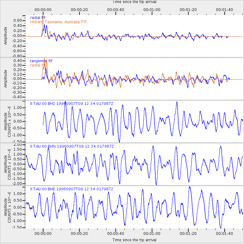
TAU Hobart, Tasmania, Australia - Earthquake Result Viewer
*The percent match for this event was below the threshold and hence no stack was calculated.
| Earthquake location: |
Solomon Islands |
| Earthquake latitude/longitude: |
-7.2/155.7 |
| Earthquake time(UTC): |
1996/09/07 (251) 09:06:00 GMT |
| Earthquake Depth: |
10 km |
| Earthquake Magnitude: |
5.6 MS, 5.4 MB, 5.8 UNKNOWN, 5.7 MW |
| Earthquake Catalog/Contributor: |
WHDF/NEIC |
|
| Network: |
II Global Seismograph Network (GSN - IRIS/IDA) |
| Station: |
TAU Hobart, Tasmania, Australia |
| Lat/Lon: |
42.91 S/147.32 E |
| Elevation: |
132 m |
|
| Distance: |
36.3 deg |
| Az: |
190.379 deg |
| Baz: |
14.082 deg |
| Ray Param: |
$rayparam |
*The percent match for this event was below the threshold and hence was not used in the summary stack. |
|
| Radial Match: |
76.76099 % |
| Radial Bump: |
400 |
| Transverse Match: |
52.819836 % |
| Transverse Bump: |
400 |
| SOD ConfigId: |
4480 |
| Insert Time: |
2010-03-02 00:36:20.552 +0000 |
| GWidth: |
2.5 |
| Max Bumps: |
400 |
| Tol: |
0.001 |
|
Signal To Noise
| Channel | StoN | STA | LTA |
| II:TAU:00:BHN:19960907T09:12:34.017987Z | 1.969362 | 1.1062076E-6 | 5.617086E-7 |
| II:TAU:00:BHE:19960907T09:12:34.017987Z | 1.1443579 | 5.3480403E-7 | 4.6733982E-7 |
| II:TAU:00:BHZ:19960907T09:12:34.017987Z | 0.7627132 | 4.852148E-7 | 6.3616943E-7 |
| Arrivals |
| Ps | |
| PpPs | |
| PsPs/PpSs | |


