You are here: Home > Network List > II - Global Seismograph Network (GSN - IRIS/IDA) Stations List
> Station TAU Hobart, Tasmania, Australia > Earthquake Result Viewer
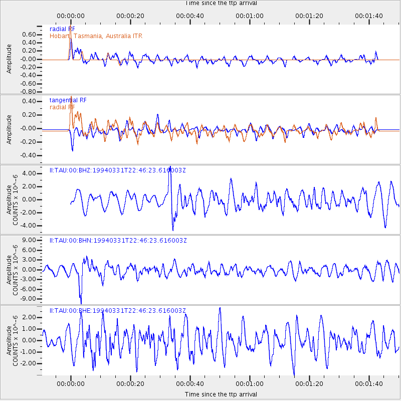
TAU Hobart, Tasmania, Australia - Earthquake Result Viewer
*The percent match for this event was below the threshold and hence no stack was calculated.
| Earthquake location: |
Fiji Islands Region |
| Earthquake latitude/longitude: |
-22.0/-179.6 |
| Earthquake time(UTC): |
1994/03/31 (090) 22:40:53 GMT |
| Earthquake Depth: |
591 km |
| Earthquake Magnitude: |
5.9 MB, 6.5 UNKNOWN, 6.5 MW |
| Earthquake Catalog/Contributor: |
WHDF/NEIC |
|
| Network: |
II Global Seismograph Network (GSN - IRIS/IDA) |
| Station: |
TAU Hobart, Tasmania, Australia |
| Lat/Lon: |
42.91 S/147.32 E |
| Elevation: |
132 m |
|
| Distance: |
34.6 deg |
| Az: |
225.011 deg |
| Baz: |
63.339 deg |
| Ray Param: |
$rayparam |
*The percent match for this event was below the threshold and hence was not used in the summary stack. |
|
| Radial Match: |
62.321697 % |
| Radial Bump: |
400 |
| Transverse Match: |
60.390087 % |
| Transverse Bump: |
400 |
| SOD ConfigId: |
4480 |
| Insert Time: |
2010-03-02 00:36:28.833 +0000 |
| GWidth: |
2.5 |
| Max Bumps: |
400 |
| Tol: |
0.001 |
|
Signal To Noise
| Channel | StoN | STA | LTA |
| II:TAU:00:BHN:19940331T22:46:23.616003Z | 2.664497 | 3.6659399E-6 | 1.375847E-6 |
| II:TAU:00:BHE:19940331T22:46:23.616003Z | 1.7725828 | 1.3468642E-6 | 7.598315E-7 |
| II:TAU:00:BHZ:19940331T22:46:23.616003Z | 2.1885037 | 2.3876814E-6 | 1.0910109E-6 |
| Arrivals |
| Ps | |
| PpPs | |
| PsPs/PpSs | |


