You are here: Home > Network List > II - Global Seismograph Network (GSN - IRIS/IDA) Stations List
> Station TAU Hobart, Tasmania, Australia > Earthquake Result Viewer
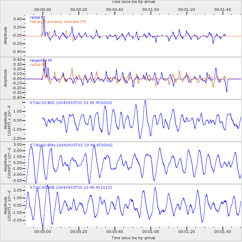
TAU Hobart, Tasmania, Australia - Earthquake Result Viewer
*The percent match for this event was below the threshold and hence no stack was calculated.
| Earthquake location: |
Kyushu, Japan |
| Earthquake latitude/longitude: |
31.3/131.2 |
| Earthquake time(UTC): |
1994/04/30 (120) 03:28:39 GMT |
| Earthquake Depth: |
30 km |
| Earthquake Magnitude: |
5.6 MB, 5.3 MS, 5.1 UNKNOWN, 5.8 MW |
| Earthquake Catalog/Contributor: |
WHDF/NEIC |
|
| Network: |
II Global Seismograph Network (GSN - IRIS/IDA) |
| Station: |
TAU Hobart, Tasmania, Australia |
| Lat/Lon: |
42.91 S/147.32 E |
| Elevation: |
132 m |
|
| Distance: |
75.3 deg |
| Az: |
167.851 deg |
| Baz: |
345.81 deg |
| Ray Param: |
$rayparam |
*The percent match for this event was below the threshold and hence was not used in the summary stack. |
|
| Radial Match: |
79.18076 % |
| Radial Bump: |
367 |
| Transverse Match: |
59.619232 % |
| Transverse Bump: |
400 |
| SOD ConfigId: |
4480 |
| Insert Time: |
2010-03-02 00:36:38.795 +0000 |
| GWidth: |
2.5 |
| Max Bumps: |
400 |
| Tol: |
0.001 |
|
Signal To Noise
| Channel | StoN | STA | LTA |
| II:TAU:00:BHN:19940430T03:39:48.459009Z | 1.6104099 | 2.0324603E-6 | 1.2620764E-6 |
| II:TAU:00:BHE:19940430T03:39:48.451013Z | 2.1371167 | 1.9000959E-6 | 8.890932E-7 |
| II:TAU:00:BHZ:19940430T03:39:48.459009Z | 1.9913943 | 9.16961E-7 | 4.6046182E-7 |
| Arrivals |
| Ps | |
| PpPs | |
| PsPs/PpSs | |


