You are here: Home > Network List > II - Global Seismograph Network (GSN - IRIS/IDA) Stations List
> Station TAU Hobart, Tasmania, Australia > Earthquake Result Viewer
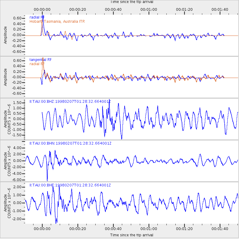
TAU Hobart, Tasmania, Australia - Earthquake Result Viewer
*The percent match for this event was below the threshold and hence no stack was calculated.
| Earthquake location: |
Volcano Islands, Japan Region |
| Earthquake latitude/longitude: |
24.8/141.7 |
| Earthquake time(UTC): |
1998/02/07 (038) 01:18:59 GMT |
| Earthquake Depth: |
525 km |
| Earthquake Magnitude: |
5.9 MB, 6.4 UNKNOWN |
| Earthquake Catalog/Contributor: |
WHDF/NEIC |
|
| Network: |
II Global Seismograph Network (GSN - IRIS/IDA) |
| Station: |
TAU Hobart, Tasmania, Australia |
| Lat/Lon: |
42.91 S/147.32 E |
| Elevation: |
132 m |
|
| Distance: |
67.6 deg |
| Az: |
175.572 deg |
| Baz: |
354.521 deg |
| Ray Param: |
$rayparam |
*The percent match for this event was below the threshold and hence was not used in the summary stack. |
|
| Radial Match: |
73.37903 % |
| Radial Bump: |
400 |
| Transverse Match: |
64.23076 % |
| Transverse Bump: |
400 |
| SOD ConfigId: |
4480 |
| Insert Time: |
2010-03-02 00:36:41.292 +0000 |
| GWidth: |
2.5 |
| Max Bumps: |
400 |
| Tol: |
0.001 |
|
Signal To Noise
| Channel | StoN | STA | LTA |
| II:TAU:00:BHN:19980207T01:28:32.664001Z | 2.3236556 | 2.1184485E-6 | 9.116878E-7 |
| II:TAU:00:BHE:19980207T01:28:32.664001Z | 1.3106076 | 1.0014733E-6 | 7.64129E-7 |
| II:TAU:00:BHZ:19980207T01:28:32.664001Z | 1.0788869 | 5.9750204E-7 | 5.5381344E-7 |
| Arrivals |
| Ps | |
| PpPs | |
| PsPs/PpSs | |


