You are here: Home > Network List > II - Global Seismograph Network (GSN - IRIS/IDA) Stations List
> Station TAU Hobart, Tasmania, Australia > Earthquake Result Viewer
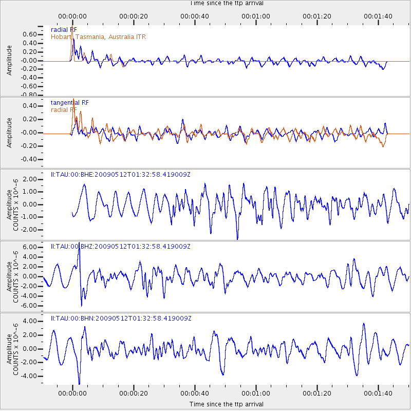
TAU Hobart, Tasmania, Australia - Earthquake Result Viewer
*The percent match for this event was below the threshold and hence no stack was calculated.
| Earthquake location: |
New Britain Region, P.N.G. |
| Earthquake latitude/longitude: |
-5.7/149.5 |
| Earthquake time(UTC): |
2009/05/12 (132) 01:26:26 GMT |
| Earthquake Depth: |
84 km |
| Earthquake Magnitude: |
5.9 MB, 6.1 MW, 6.1 MW |
| Earthquake Catalog/Contributor: |
WHDF/NEIC |
|
| Network: |
II Global Seismograph Network (GSN - IRIS/IDA) |
| Station: |
TAU Hobart, Tasmania, Australia |
| Lat/Lon: |
42.91 S/147.32 E |
| Elevation: |
132 m |
|
| Distance: |
37.2 deg |
| Az: |
182.703 deg |
| Baz: |
3.662 deg |
| Ray Param: |
$rayparam |
*The percent match for this event was below the threshold and hence was not used in the summary stack. |
|
| Radial Match: |
61.501526 % |
| Radial Bump: |
400 |
| Transverse Match: |
46.41469 % |
| Transverse Bump: |
400 |
| SOD ConfigId: |
2760 |
| Insert Time: |
2010-03-02 00:36:44.456 +0000 |
| GWidth: |
2.5 |
| Max Bumps: |
400 |
| Tol: |
0.001 |
|
Signal To Noise
| Channel | StoN | STA | LTA |
| II:TAU:00:BHZ:20090512T01:32:58.419009Z | 3.5927913 | 3.2321254E-6 | 8.99614E-7 |
| II:TAU:00:BHN:20090512T01:32:58.419009Z | 1.9863982 | 2.2680267E-6 | 1.1417784E-6 |
| II:TAU:00:BHE:20090512T01:32:58.419009Z | 0.8798731 | 6.68768E-7 | 7.600732E-7 |
| Arrivals |
| Ps | |
| PpPs | |
| PsPs/PpSs | |


