You are here: Home > Network List > II - Global Seismograph Network (GSN - IRIS/IDA) Stations List
> Station TAU Hobart, Tasmania, Australia > Earthquake Result Viewer
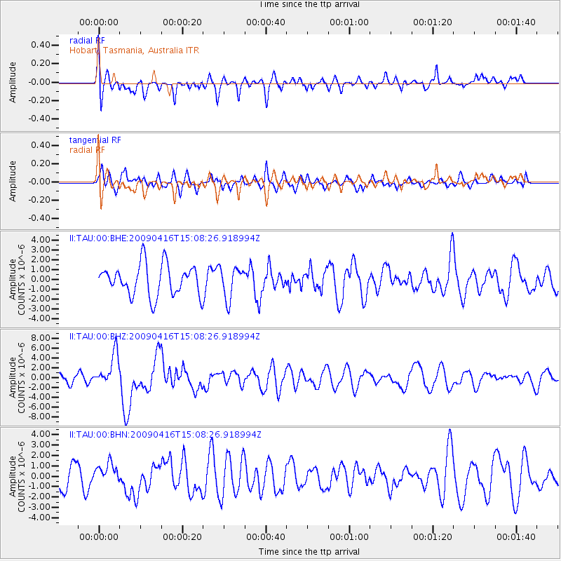
TAU Hobart, Tasmania, Australia - Earthquake Result Viewer
*The percent match for this event was below the threshold and hence no stack was calculated.
| Earthquake location: |
South Sandwich Islands Region |
| Earthquake latitude/longitude: |
-60.2/-26.9 |
| Earthquake time(UTC): |
2009/04/16 (106) 14:57:06 GMT |
| Earthquake Depth: |
20 km |
| Earthquake Magnitude: |
6.2 MB, 6.8 MS, 6.7 MW, 6.7 MW |
| Earthquake Catalog/Contributor: |
WHDF/NEIC |
|
| Network: |
II Global Seismograph Network (GSN - IRIS/IDA) |
| Station: |
TAU Hobart, Tasmania, Australia |
| Lat/Lon: |
42.91 S/147.32 E |
| Elevation: |
132 m |
|
| Distance: |
77.1 deg |
| Az: |
175.616 deg |
| Baz: |
182.979 deg |
| Ray Param: |
$rayparam |
*The percent match for this event was below the threshold and hence was not used in the summary stack. |
|
| Radial Match: |
48.23722 % |
| Radial Bump: |
400 |
| Transverse Match: |
46.75783 % |
| Transverse Bump: |
400 |
| SOD ConfigId: |
2658 |
| Insert Time: |
2010-03-02 00:36:46.666 +0000 |
| GWidth: |
2.5 |
| Max Bumps: |
400 |
| Tol: |
0.001 |
|
Signal To Noise
| Channel | StoN | STA | LTA |
| II:TAU:00:BHZ:20090416T15:08:26.918994Z | 2.9715548 | 3.498459E-6 | 1.177316E-6 |
| II:TAU:00:BHN:20090416T15:08:26.918994Z | 0.5116757 | 1.0238515E-6 | 2.0009772E-6 |
| II:TAU:00:BHE:20090416T15:08:26.918994Z | 1.0096918 | 1.6039196E-6 | 1.5885239E-6 |
| Arrivals |
| Ps | |
| PpPs | |
| PsPs/PpSs | |


