You are here: Home > Network List > II - Global Seismograph Network (GSN - IRIS/IDA) Stations List
> Station TAU Hobart, Tasmania, Australia > Earthquake Result Viewer
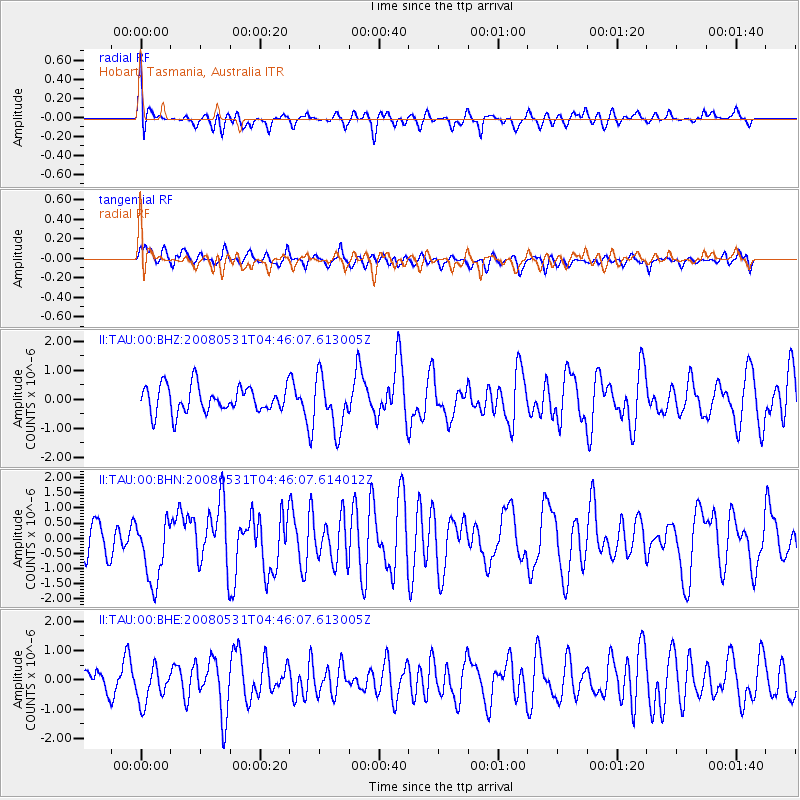
TAU Hobart, Tasmania, Australia - Earthquake Result Viewer
*The percent match for this event was below the threshold and hence no stack was calculated.
| Earthquake location: |
Mid-Indian Ridge |
| Earthquake latitude/longitude: |
-41.2/80.5 |
| Earthquake time(UTC): |
2008/05/31 (152) 04:37:56 GMT |
| Earthquake Depth: |
10 km |
| Earthquake Magnitude: |
6.0 MB, 6.3 MS, 6.4 MW, 6.4 MW |
| Earthquake Catalog/Contributor: |
WHDF/NEIC |
|
| Network: |
II Global Seismograph Network (GSN - IRIS/IDA) |
| Station: |
TAU Hobart, Tasmania, Australia |
| Lat/Lon: |
42.91 S/147.32 E |
| Elevation: |
132 m |
|
| Distance: |
48.4 deg |
| Az: |
115.485 deg |
| Baz: |
247.962 deg |
| Ray Param: |
$rayparam |
*The percent match for this event was below the threshold and hence was not used in the summary stack. |
|
| Radial Match: |
53.23738 % |
| Radial Bump: |
400 |
| Transverse Match: |
50.91468 % |
| Transverse Bump: |
400 |
| SOD ConfigId: |
2504 |
| Insert Time: |
2010-03-02 00:36:48.145 +0000 |
| GWidth: |
2.5 |
| Max Bumps: |
400 |
| Tol: |
0.001 |
|
Signal To Noise
| Channel | StoN | STA | LTA |
| II:TAU:00:BHN:20080531T04:46:07.614012Z | 2.1590765 | 1.0578186E-6 | 4.8994036E-7 |
| II:TAU:00:BHE:20080531T04:46:07.613005Z | 1.4284912 | 6.0943546E-7 | 4.2662876E-7 |
| II:TAU:00:BHZ:20080531T04:46:07.613005Z | 1.9690688 | 8.9682277E-7 | 4.554553E-7 |
| Arrivals |
| Ps | |
| PpPs | |
| PsPs/PpSs | |


