You are here: Home > Network List > II - Global Seismograph Network (GSN - IRIS/IDA) Stations List
> Station TAU Hobart, Tasmania, Australia > Earthquake Result Viewer
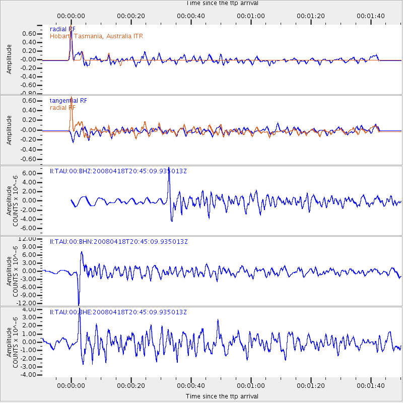
TAU Hobart, Tasmania, Australia - Earthquake Result Viewer
*The percent match for this event was below the threshold and hence no stack was calculated.
| Earthquake location: |
Fiji Islands Region |
| Earthquake latitude/longitude: |
-17.3/-179.0 |
| Earthquake time(UTC): |
2008/04/18 (109) 20:39:07 GMT |
| Earthquake Depth: |
554 km |
| Earthquake Magnitude: |
5.9 MB, 6.3 MW, 6.3 MW |
| Earthquake Catalog/Contributor: |
WHDF/NEIC |
|
| Network: |
II Global Seismograph Network (GSN - IRIS/IDA) |
| Station: |
TAU Hobart, Tasmania, Australia |
| Lat/Lon: |
42.91 S/147.32 E |
| Elevation: |
132 m |
|
| Distance: |
38.3 deg |
| Az: |
221.1 deg |
| Baz: |
58.715 deg |
| Ray Param: |
$rayparam |
*The percent match for this event was below the threshold and hence was not used in the summary stack. |
|
| Radial Match: |
70.41428 % |
| Radial Bump: |
400 |
| Transverse Match: |
69.938965 % |
| Transverse Bump: |
400 |
| SOD ConfigId: |
2504 |
| Insert Time: |
2010-03-02 00:36:50.447 +0000 |
| GWidth: |
2.5 |
| Max Bumps: |
400 |
| Tol: |
0.001 |
|
Signal To Noise
| Channel | StoN | STA | LTA |
| II:TAU:00:BHN:20080418T20:45:09.935013Z | 9.872077 | 4.2676033E-6 | 4.3229034E-7 |
| II:TAU:00:BHE:20080418T20:45:09.935013Z | 3.926647 | 1.5191807E-6 | 3.868901E-7 |
| II:TAU:00:BHZ:20080418T20:45:09.935013Z | 4.616814 | 2.5462184E-6 | 5.5150986E-7 |
| Arrivals |
| Ps | |
| PpPs | |
| PsPs/PpSs | |


