You are here: Home > Network List > UW - Pacific Northwest Regional Seismic Network Stations List
> Station UMAT Pilot Rock, OR, USA > Earthquake Result Viewer
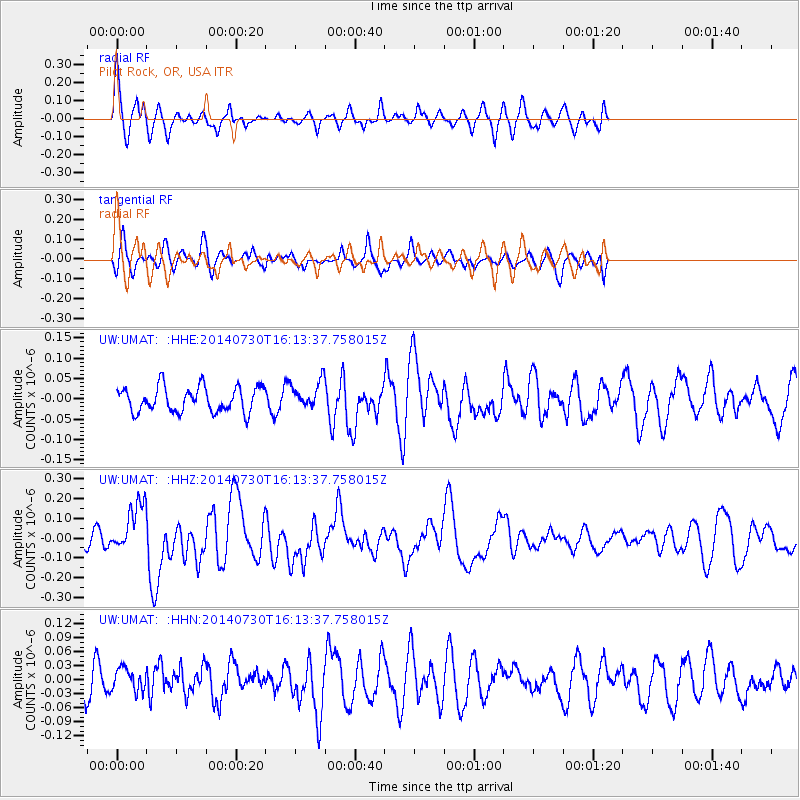
UMAT Pilot Rock, OR, USA - Earthquake Result Viewer
*The percent match for this event was below the threshold and hence no stack was calculated.
| Earthquake location: |
Solomon Islands |
| Earthquake latitude/longitude: |
-7.2/154.8 |
| Earthquake time(UTC): |
2014/07/30 (211) 16:00:58 GMT |
| Earthquake Depth: |
10 km |
| Earthquake Magnitude: |
5.7 MWB |
| Earthquake Catalog/Contributor: |
NEIC PDE/NEIC COMCAT |
|
| Network: |
UW Pacific Northwest Regional Seismic Network |
| Station: |
UMAT Pilot Rock, OR, USA |
| Lat/Lon: |
45.29 N/118.96 W |
| Elevation: |
1318 m |
|
| Distance: |
92.4 deg |
| Az: |
44.826 deg |
| Baz: |
262.275 deg |
| Ray Param: |
$rayparam |
*The percent match for this event was below the threshold and hence was not used in the summary stack. |
|
| Radial Match: |
63.715942 % |
| Radial Bump: |
400 |
| Transverse Match: |
51.508755 % |
| Transverse Bump: |
400 |
| SOD ConfigId: |
769524 |
| Insert Time: |
2014-08-13 16:31:18.239 +0000 |
| GWidth: |
2.5 |
| Max Bumps: |
400 |
| Tol: |
0.001 |
|
Signal To Noise
| Channel | StoN | STA | LTA |
| UW:UMAT: :HHZ:20140730T16:13:37.758015Z | 2.559722 | 1.2474973E-7 | 4.8735657E-8 |
| UW:UMAT: :HHN:20140730T16:13:37.758015Z | 0.63641155 | 2.4533298E-8 | 3.8549423E-8 |
| UW:UMAT: :HHE:20140730T16:13:37.758015Z | 1.0522772 | 3.2381347E-8 | 3.0772636E-8 |
| Arrivals |
| Ps | |
| PpPs | |
| PsPs/PpSs | |


