You are here: Home > Network List > II - Global Seismograph Network (GSN - IRIS/IDA) Stations List
> Station TAU Hobart, Tasmania, Australia > Earthquake Result Viewer
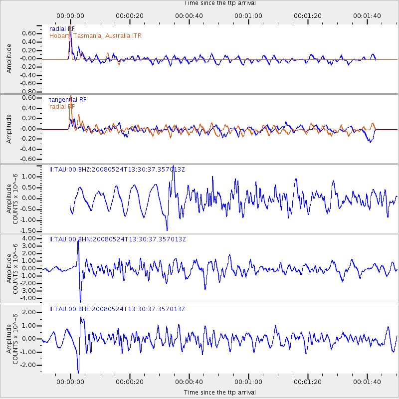
TAU Hobart, Tasmania, Australia - Earthquake Result Viewer
*The percent match for this event was below the threshold and hence no stack was calculated.
| Earthquake location: |
Solomon Islands |
| Earthquake latitude/longitude: |
-7.2/156.1 |
| Earthquake time(UTC): |
2008/05/24 (145) 13:24:05 GMT |
| Earthquake Depth: |
29 km |
| Earthquake Magnitude: |
5.8 MB, 5.5 MS, 5.9 MW, 5.8 MW |
| Earthquake Catalog/Contributor: |
WHDF/NEIC |
|
| Network: |
II Global Seismograph Network (GSN - IRIS/IDA) |
| Station: |
TAU Hobart, Tasmania, Australia |
| Lat/Lon: |
42.91 S/147.32 E |
| Elevation: |
132 m |
|
| Distance: |
36.4 deg |
| Az: |
190.851 deg |
| Baz: |
14.73 deg |
| Ray Param: |
$rayparam |
*The percent match for this event was below the threshold and hence was not used in the summary stack. |
|
| Radial Match: |
68.0477 % |
| Radial Bump: |
400 |
| Transverse Match: |
65.33303 % |
| Transverse Bump: |
400 |
| SOD ConfigId: |
2504 |
| Insert Time: |
2010-03-02 00:36:55.121 +0000 |
| GWidth: |
2.5 |
| Max Bumps: |
400 |
| Tol: |
0.001 |
|
Signal To Noise
| Channel | StoN | STA | LTA |
| II:TAU:00:BHN:20080524T13:30:37.357013Z | 6.075701 | 1.6618194E-6 | 2.7351894E-7 |
| II:TAU:00:BHE:20080524T13:30:37.357013Z | 3.1611187 | 1.1400676E-6 | 3.6065325E-7 |
| II:TAU:00:BHZ:20080524T13:30:37.357013Z | 1.902412 | 7.72172E-7 | 4.0589103E-7 |
| Arrivals |
| Ps | |
| PpPs | |
| PsPs/PpSs | |


