You are here: Home > Network List > II - Global Seismograph Network (GSN - IRIS/IDA) Stations List
> Station TAU Hobart, Tasmania, Australia > Earthquake Result Viewer
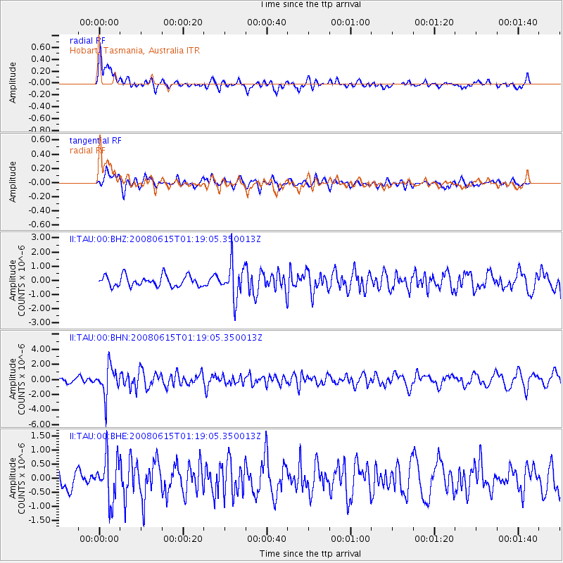
TAU Hobart, Tasmania, Australia - Earthquake Result Viewer
*The percent match for this event was below the threshold and hence no stack was calculated.
| Earthquake location: |
Fiji Islands Region |
| Earthquake latitude/longitude: |
-17.7/-179.7 |
| Earthquake time(UTC): |
2008/06/15 (167) 01:13:11 GMT |
| Earthquake Depth: |
611 km |
| Earthquake Magnitude: |
5.5 MB, 5.9 MW, 5.9 MW |
| Earthquake Catalog/Contributor: |
WHDF/NEIC |
|
| Network: |
II Global Seismograph Network (GSN - IRIS/IDA) |
| Station: |
TAU Hobart, Tasmania, Australia |
| Lat/Lon: |
42.91 S/147.32 E |
| Elevation: |
132 m |
|
| Distance: |
37.5 deg |
| Az: |
220.986 deg |
| Baz: |
58.3 deg |
| Ray Param: |
$rayparam |
*The percent match for this event was below the threshold and hence was not used in the summary stack. |
|
| Radial Match: |
55.230183 % |
| Radial Bump: |
400 |
| Transverse Match: |
49.449715 % |
| Transverse Bump: |
400 |
| SOD ConfigId: |
2504 |
| Insert Time: |
2010-03-02 00:36:58.003 +0000 |
| GWidth: |
2.5 |
| Max Bumps: |
400 |
| Tol: |
0.001 |
|
Signal To Noise
| Channel | StoN | STA | LTA |
| II:TAU:00:BHN:20080615T01:19:05.350013Z | 4.467637 | 1.9713916E-6 | 4.4126048E-7 |
| II:TAU:00:BHE:20080615T01:19:05.350013Z | 2.0246582 | 7.9601296E-7 | 3.9315918E-7 |
| II:TAU:00:BHZ:20080615T01:19:05.350013Z | 3.3316329 | 1.248086E-6 | 3.746169E-7 |
| Arrivals |
| Ps | |
| PpPs | |
| PsPs/PpSs | |


