You are here: Home > Network List > II - Global Seismograph Network (GSN - IRIS/IDA) Stations List
> Station TAU Hobart, Tasmania, Australia > Earthquake Result Viewer
TAU Hobart, Tasmania, Australia - Earthquake Result Viewer
*The percent match for this event was below the threshold and hence no stack was calculated.
| Earthquake location: |
Minahassa Peninsula, Sulawesi |
| Earthquake latitude/longitude: |
0.1/120.7 |
| Earthquake time(UTC): |
2008/10/20 (294) 04:54:19 GMT |
| Earthquake Depth: |
102 km |
| Earthquake Magnitude: |
6.1 MB, 5.9 MW, 5.8 MW |
| Earthquake Catalog/Contributor: |
WHDF/NEIC |
|
| Network: |
II Global Seismograph Network (GSN - IRIS/IDA) |
| Station: |
TAU Hobart, Tasmania, Australia |
| Lat/Lon: |
42.91 S/147.32 E |
| Elevation: |
132 m |
|
| Distance: |
49.0 deg |
| Az: |
154.122 deg |
| Baz: |
323.554 deg |
| Ray Param: |
$rayparam |
*The percent match for this event was below the threshold and hence was not used in the summary stack. |
|
| Radial Match: |
71.13124 % |
| Radial Bump: |
400 |
| Transverse Match: |
53.427963 % |
| Transverse Bump: |
400 |
| SOD ConfigId: |
2556 |
| Insert Time: |
2010-03-02 00:36:58.561 +0000 |
| GWidth: |
2.5 |
| Max Bumps: |
400 |
| Tol: |
0.001 |
|
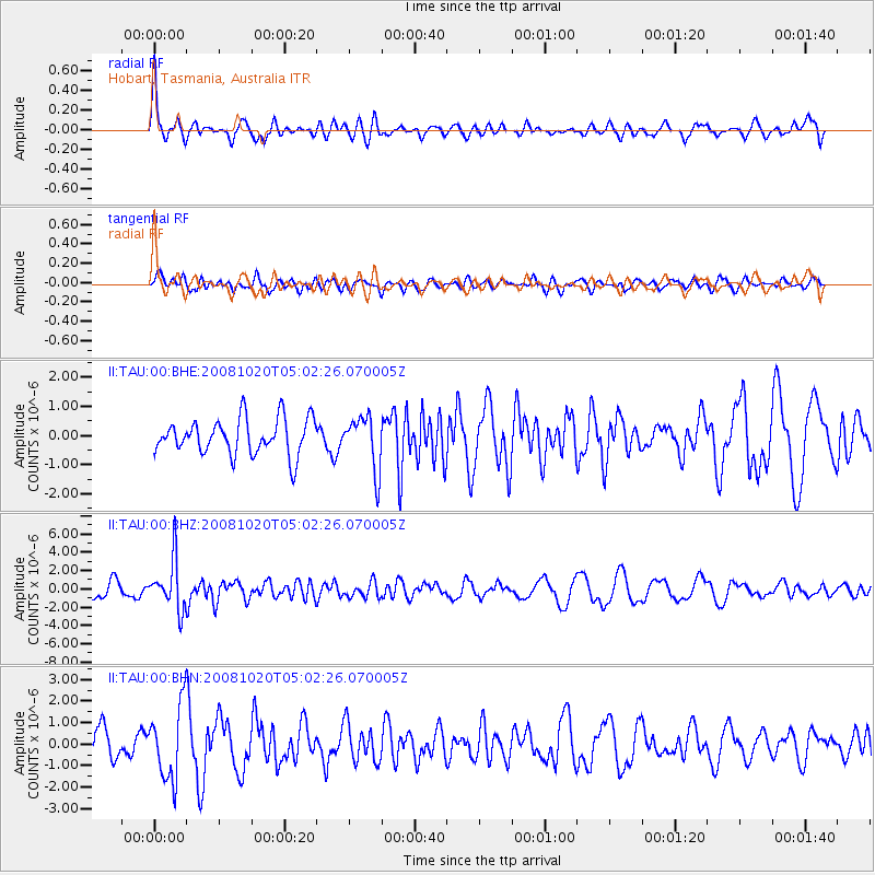
Signal To Noise
| Channel | StoN | STA | LTA |
| II:TAU:00:BHZ:20081020T05:02:26.070005Z | 2.015325 | 2.7177857E-6 | 1.3485593E-6 |
| II:TAU:00:BHN:20081020T05:02:26.070005Z | 3.0419528 | 1.6958636E-6 | 5.574918E-7 |
| II:TAU:00:BHE:20081020T05:02:26.070005Z | 1.4990882 | 9.1671285E-7 | 6.115136E-7 |
| Arrivals |
| Ps | |
| PpPs | |
| PsPs/PpSs | |


