You are here: Home > Network List > II - Global Seismograph Network (GSN - IRIS/IDA) Stations List
> Station TAU Hobart, Tasmania, Australia > Earthquake Result Viewer
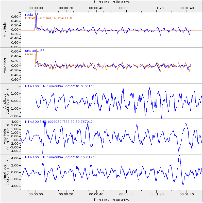
TAU Hobart, Tasmania, Australia - Earthquake Result Viewer
*The percent match for this event was below the threshold and hence no stack was calculated.
| Earthquake location: |
Tanimbar Islands Reg., Indonesia |
| Earthquake latitude/longitude: |
-6.3/131.5 |
| Earthquake time(UTC): |
1994/08/04 (216) 22:15:37 GMT |
| Earthquake Depth: |
33 km |
| Earthquake Magnitude: |
6.1 MB, 5.6 MS, 6.1 UNKNOWN |
| Earthquake Catalog/Contributor: |
WHDF/NEIC |
|
| Network: |
II Global Seismograph Network (GSN - IRIS/IDA) |
| Station: |
TAU Hobart, Tasmania, Australia |
| Lat/Lon: |
42.91 S/147.32 E |
| Elevation: |
132 m |
|
| Distance: |
39.0 deg |
| Az: |
161.489 deg |
| Baz: |
334.562 deg |
| Ray Param: |
$rayparam |
*The percent match for this event was below the threshold and hence was not used in the summary stack. |
|
| Radial Match: |
73.4226 % |
| Radial Bump: |
400 |
| Transverse Match: |
62.26928 % |
| Transverse Bump: |
400 |
| SOD ConfigId: |
4480 |
| Insert Time: |
2010-03-02 00:37:03.445 +0000 |
| GWidth: |
2.5 |
| Max Bumps: |
400 |
| Tol: |
0.001 |
|
Signal To Noise
| Channel | StoN | STA | LTA |
| II:TAU:00:BHN:19940804T22:22:30.76701Z | 1.7021978 | 1.5967767E-6 | 9.3806756E-7 |
| II:TAU:00:BHE:19940804T22:22:30.776013Z | 1.5365496 | 9.786677E-7 | 6.3692556E-7 |
| II:TAU:00:BHZ:19940804T22:22:30.76701Z | 0.52445084 | 3.2280383E-7 | 6.1550827E-7 |
| Arrivals |
| Ps | |
| PpPs | |
| PsPs/PpSs | |


