You are here: Home > Network List > II - Global Seismograph Network (GSN - IRIS/IDA) Stations List
> Station TAU Hobart, Tasmania, Australia > Earthquake Result Viewer
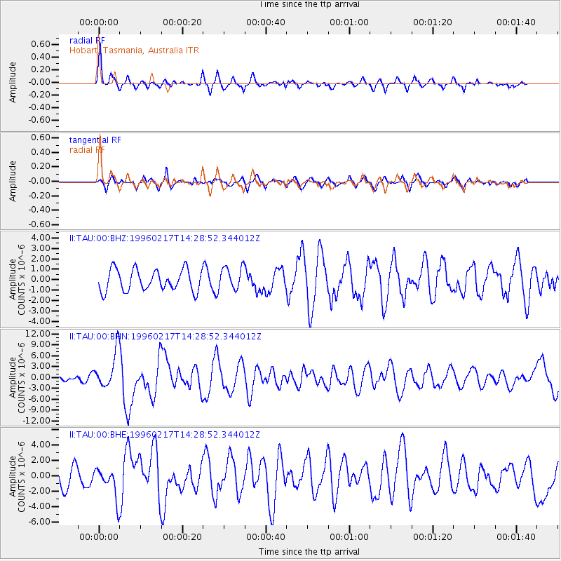
TAU Hobart, Tasmania, Australia - Earthquake Result Viewer
*The percent match for this event was below the threshold and hence no stack was calculated.
| Earthquake location: |
Irian Jaya Region, Indonesia |
| Earthquake latitude/longitude: |
-0.6/135.9 |
| Earthquake time(UTC): |
1996/02/17 (048) 14:21:23 GMT |
| Earthquake Depth: |
33 km |
| Earthquake Magnitude: |
5.8 MB, 6.7 MS, 6.7 UNKNOWN, 6.4 MW |
| Earthquake Catalog/Contributor: |
WHDF/NEIC |
|
| Network: |
II Global Seismograph Network (GSN - IRIS/IDA) |
| Station: |
TAU Hobart, Tasmania, Australia |
| Lat/Lon: |
42.91 S/147.32 E |
| Elevation: |
132 m |
|
| Distance: |
43.4 deg |
| Az: |
167.74 deg |
| Baz: |
343.202 deg |
| Ray Param: |
$rayparam |
*The percent match for this event was below the threshold and hence was not used in the summary stack. |
|
| Radial Match: |
78.12858 % |
| Radial Bump: |
400 |
| Transverse Match: |
72.16866 % |
| Transverse Bump: |
400 |
| SOD ConfigId: |
4480 |
| Insert Time: |
2010-03-02 00:37:04.468 +0000 |
| GWidth: |
2.5 |
| Max Bumps: |
400 |
| Tol: |
0.001 |
|
Signal To Noise
| Channel | StoN | STA | LTA |
| II:TAU:00:BHN:19960217T14:28:52.344012Z | 6.657995 | 5.220463E-6 | 7.8408937E-7 |
| II:TAU:00:BHE:19960217T14:28:52.344012Z | 1.4079506 | 2.023275E-6 | 1.4370355E-6 |
| II:TAU:00:BHZ:19960217T14:28:52.344012Z | 1.0684106 | 1.0852756E-6 | 1.0157851E-6 |
| Arrivals |
| Ps | |
| PpPs | |
| PsPs/PpSs | |


