You are here: Home > Network List > II - Global Seismograph Network (GSN - IRIS/IDA) Stations List
> Station TAU Hobart, Tasmania, Australia > Earthquake Result Viewer
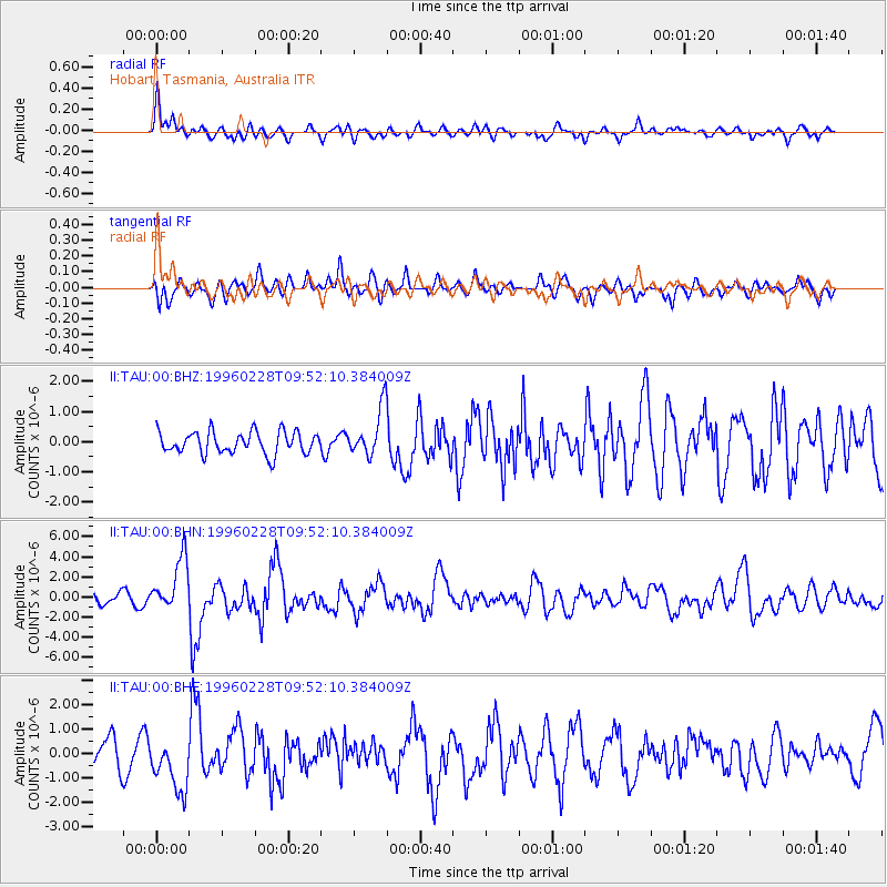
TAU Hobart, Tasmania, Australia - Earthquake Result Viewer
*The percent match for this event was below the threshold and hence no stack was calculated.
| Earthquake location: |
Northern Molucca Sea |
| Earthquake latitude/longitude: |
1.7/126.1 |
| Earthquake time(UTC): |
1996/02/28 (059) 09:44:09 GMT |
| Earthquake Depth: |
103 km |
| Earthquake Magnitude: |
6.1 MB, 6.4 UNKNOWN, 6.4 MW |
| Earthquake Catalog/Contributor: |
WHDF/NEIC |
|
| Network: |
II Global Seismograph Network (GSN - IRIS/IDA) |
| Station: |
TAU Hobart, Tasmania, Australia |
| Lat/Lon: |
42.91 S/147.32 E |
| Elevation: |
132 m |
|
| Distance: |
48.4 deg |
| Az: |
159.161 deg |
| Baz: |
331.054 deg |
| Ray Param: |
$rayparam |
*The percent match for this event was below the threshold and hence was not used in the summary stack. |
|
| Radial Match: |
71.664406 % |
| Radial Bump: |
400 |
| Transverse Match: |
52.728886 % |
| Transverse Bump: |
400 |
| SOD ConfigId: |
4480 |
| Insert Time: |
2010-03-02 00:37:07.833 +0000 |
| GWidth: |
2.5 |
| Max Bumps: |
400 |
| Tol: |
0.001 |
|
Signal To Noise
| Channel | StoN | STA | LTA |
| II:TAU:00:BHN:19960228T09:52:10.384009Z | 1.8532224 | 2.6375128E-6 | 1.4232037E-6 |
| II:TAU:00:BHE:19960228T09:52:10.384009Z | 1.8634998 | 1.0838756E-6 | 5.816345E-7 |
| II:TAU:00:BHZ:19960228T09:52:10.384009Z | 2.176218 | 7.925049E-7 | 3.6416614E-7 |
| Arrivals |
| Ps | |
| PpPs | |
| PsPs/PpSs | |


