You are here: Home > Network List > II - Global Seismograph Network (GSN - IRIS/IDA) Stations List
> Station TAU Hobart, Tasmania, Australia > Earthquake Result Viewer
TAU Hobart, Tasmania, Australia - Earthquake Result Viewer
*The percent match for this event was below the threshold and hence no stack was calculated.
| Earthquake location: |
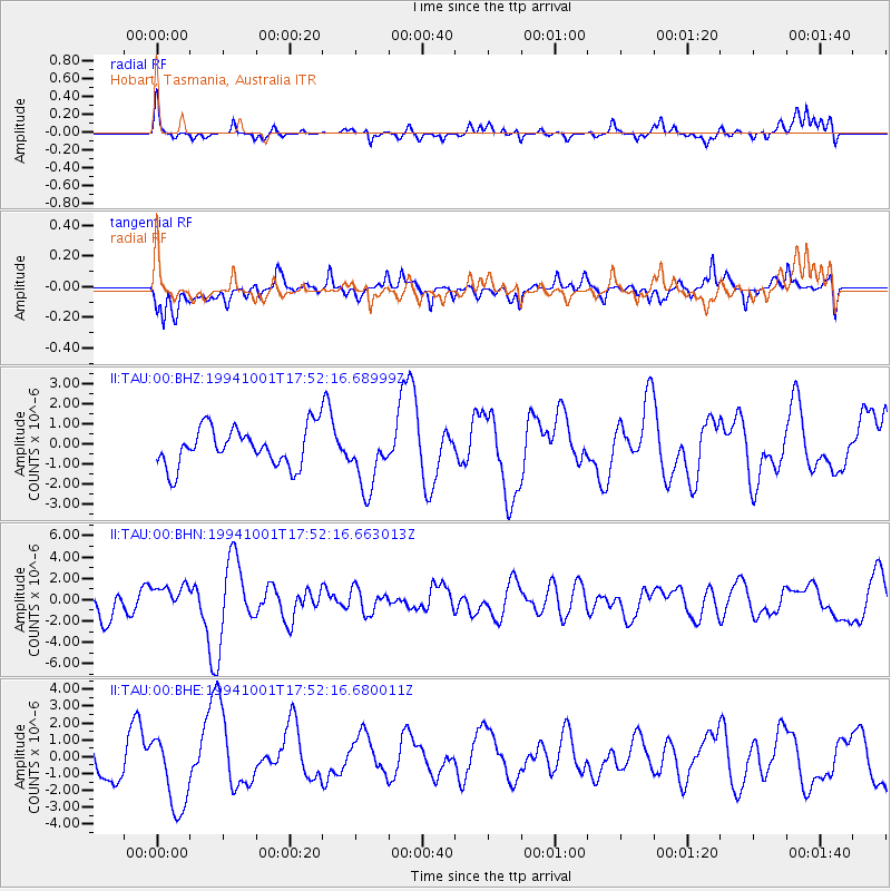
Vanuatu Islands |
| Earthquake latitude/longitude: |
-17.8/167.8 |
| Earthquake time(UTC): |
1994/10/01 (274) 17:46:37 GMT |
| Earthquake Depth: |
33 km |
| Earthquake Magnitude: |
5.6 MB, 6.3 MS, 6.3 UNKNOWN |
| Earthquake Catalog/Contributor: |
WHDF/NEIC |
|
| Network: |
II Global Seismograph Network (GSN - IRIS/IDA) |
| Station: |
TAU Hobart, Tasmania, Australia |
| Lat/Lon: |
42.91 S/147.32 E |
| Elevation: |
132 m |
|
| Distance: |
30.5 deg |
| Az: |
210.47 deg |
| Baz: |
41.111 deg |
| Ray Param: |
$rayparam |
*The percent match for this event was below the threshold and hence was not used in the summary stack. |
|
| Radial Match: |
57.51283 % |
| Radial Bump: |
376 |
| Transverse Match: |
50.997692 % |
| Transverse Bump: |
400 |
| SOD ConfigId: |
4480 |
| Insert Time: |
2010-03-02 00:37:09.171 +0000 |
| GWidth: |
2.5 |
| Max Bumps: |
400 |
| Tol: |
0.001 |
|
Signal To Noise
| Channel | StoN | STA | LTA |
| II:TAU:00:BHN:19941001T17:52:16.663013Z | 0.6839644 | 1.2071799E-6 | 1.7649749E-6 |
| II:TAU:00:BHE:19941001T17:52:16.680011Z | 1.6816069 | 2.256953E-6 | 1.3421406E-6 |
| II:TAU:00:BHZ:19941001T17:52:16.68999Z | 1.6192592 | 1.5481081E-6 | 9.560595E-7 |
| Arrivals |
| Ps | |
| PpPs | |
| PsPs/PpSs | |


