You are here: Home > Network List > II - Global Seismograph Network (GSN - IRIS/IDA) Stations List
> Station TAU Hobart, Tasmania, Australia > Earthquake Result Viewer
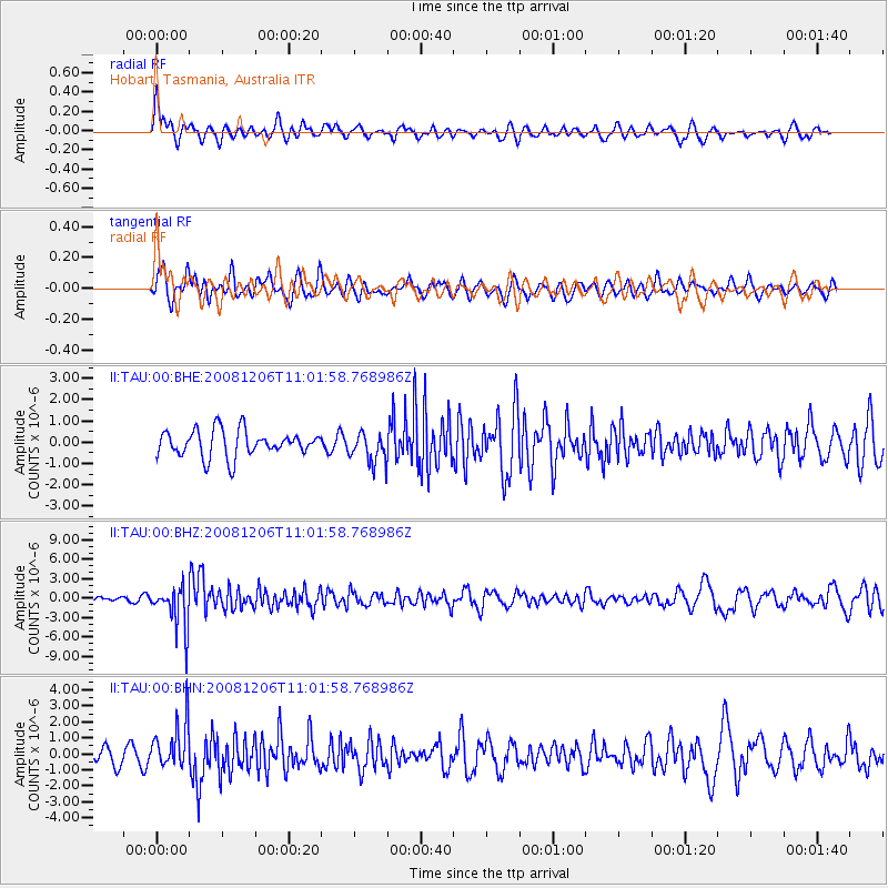
TAU Hobart, Tasmania, Australia - Earthquake Result Viewer
*The percent match for this event was below the threshold and hence no stack was calculated.
| Earthquake location: |
Banda Sea |
| Earthquake latitude/longitude: |
-7.4/124.7 |
| Earthquake time(UTC): |
2008/12/06 (341) 10:55:27 GMT |
| Earthquake Depth: |
405 km |
| Earthquake Magnitude: |
6.1 MB, 6.4 MW, 6.4 MW |
| Earthquake Catalog/Contributor: |
WHDF/NEIC |
|
| Network: |
II Global Seismograph Network (GSN - IRIS/IDA) |
| Station: |
TAU Hobart, Tasmania, Australia |
| Lat/Lon: |
42.91 S/147.32 E |
| Elevation: |
132 m |
|
| Distance: |
40.6 deg |
| Az: |
154.293 deg |
| Baz: |
324.158 deg |
| Ray Param: |
$rayparam |
*The percent match for this event was below the threshold and hence was not used in the summary stack. |
|
| Radial Match: |
71.86583 % |
| Radial Bump: |
400 |
| Transverse Match: |
61.251892 % |
| Transverse Bump: |
400 |
| SOD ConfigId: |
2658 |
| Insert Time: |
2010-03-02 00:37:19.778 +0000 |
| GWidth: |
2.5 |
| Max Bumps: |
400 |
| Tol: |
0.001 |
|
Signal To Noise
| Channel | StoN | STA | LTA |
| II:TAU:00:BHZ:20081206T11:01:58.768986Z | 7.36319 | 3.3485915E-6 | 4.5477455E-7 |
| II:TAU:00:BHN:20081206T11:01:58.768986Z | 3.339069 | 1.472763E-6 | 4.4106997E-7 |
| II:TAU:00:BHE:20081206T11:01:58.768986Z | 1.1541963 | 7.146413E-7 | 6.1916796E-7 |
| Arrivals |
| Ps | |
| PpPs | |
| PsPs/PpSs | |


