You are here: Home > Network List > II - Global Seismograph Network (GSN - IRIS/IDA) Stations List
> Station TAU Hobart, Tasmania, Australia > Earthquake Result Viewer
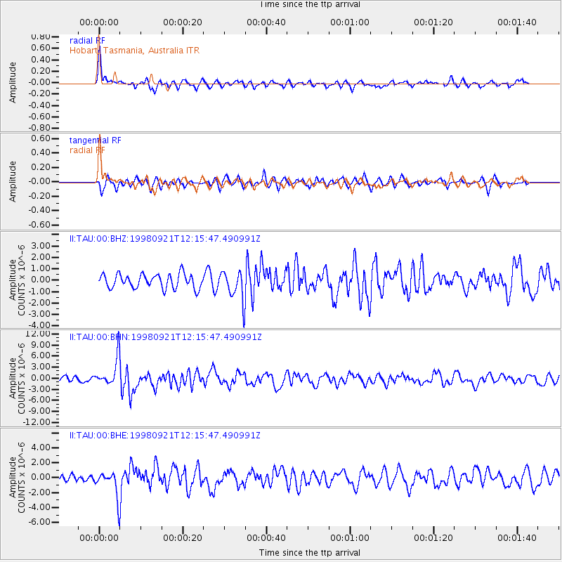
TAU Hobart, Tasmania, Australia - Earthquake Result Viewer
*The percent match for this event was below the threshold and hence no stack was calculated.
| Earthquake location: |
Vanuatu Islands |
| Earthquake latitude/longitude: |
-13.6/166.8 |
| Earthquake time(UTC): |
1998/09/21 (264) 12:09:39 GMT |
| Earthquake Depth: |
33 km |
| Earthquake Magnitude: |
6.0 MB, 6.3 MS, 6.4 UNKNOWN, 6.3 MW |
| Earthquake Catalog/Contributor: |
WHDF/NEIC |
|
| Network: |
II Global Seismograph Network (GSN - IRIS/IDA) |
| Station: |
TAU Hobart, Tasmania, Australia |
| Lat/Lon: |
42.91 S/147.32 E |
| Elevation: |
132 m |
|
| Distance: |
33.7 deg |
| Az: |
206.179 deg |
| Baz: |
35.727 deg |
| Ray Param: |
$rayparam |
*The percent match for this event was below the threshold and hence was not used in the summary stack. |
|
| Radial Match: |
67.26149 % |
| Radial Bump: |
388 |
| Transverse Match: |
55.525547 % |
| Transverse Bump: |
382 |
| SOD ConfigId: |
4480 |
| Insert Time: |
2010-03-02 00:37:28.940 +0000 |
| GWidth: |
2.5 |
| Max Bumps: |
400 |
| Tol: |
0.001 |
|
Signal To Noise
| Channel | StoN | STA | LTA |
| II:TAU:00:BHN:19980921T12:15:47.490991Z | 5.1180067 | 4.0068294E-6 | 7.828887E-7 |
| II:TAU:00:BHE:19980921T12:15:47.490991Z | 4.838783 | 1.8583909E-6 | 3.8406165E-7 |
| II:TAU:00:BHZ:19980921T12:15:47.490991Z | 2.1693769 | 1.3384088E-6 | 6.1695545E-7 |
| Arrivals |
| Ps | |
| PpPs | |
| PsPs/PpSs | |


