You are here: Home > Network List > II - Global Seismograph Network (GSN - IRIS/IDA) Stations List
> Station TAU Hobart, Tasmania, Australia > Earthquake Result Viewer
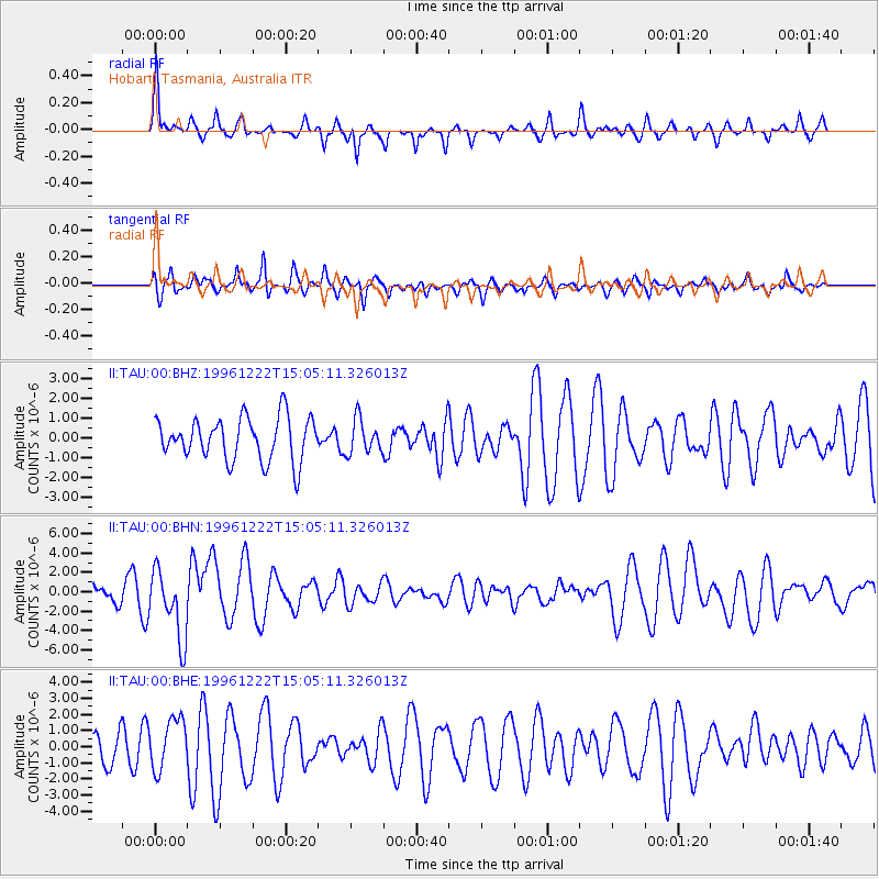
TAU Hobart, Tasmania, Australia - Earthquake Result Viewer
*The percent match for this event was below the threshold and hence no stack was calculated.
| Earthquake location: |
Eastern Sea Of Japan |
| Earthquake latitude/longitude: |
43.2/138.9 |
| Earthquake time(UTC): |
1996/12/22 (357) 14:53:27 GMT |
| Earthquake Depth: |
227 km |
| Earthquake Magnitude: |
6.0 MB, 6.5 UNKNOWN, 6.5 MW |
| Earthquake Catalog/Contributor: |
WHDF/NEIC |
|
| Network: |
II Global Seismograph Network (GSN - IRIS/IDA) |
| Station: |
TAU Hobart, Tasmania, Australia |
| Lat/Lon: |
42.91 S/147.32 E |
| Elevation: |
132 m |
|
| Distance: |
86.1 deg |
| Az: |
173.824 deg |
| Baz: |
353.854 deg |
| Ray Param: |
$rayparam |
*The percent match for this event was below the threshold and hence was not used in the summary stack. |
|
| Radial Match: |
71.1939 % |
| Radial Bump: |
285 |
| Transverse Match: |
58.81528 % |
| Transverse Bump: |
353 |
| SOD ConfigId: |
4480 |
| Insert Time: |
2010-03-02 00:37:36.598 +0000 |
| GWidth: |
2.5 |
| Max Bumps: |
400 |
| Tol: |
0.001 |
|
Signal To Noise
| Channel | StoN | STA | LTA |
| II:TAU:00:BHN:19961222T15:05:11.326013Z | 2.8842878 | 3.577047E-6 | 1.2401838E-6 |
| II:TAU:00:BHE:19961222T15:05:11.326013Z | 1.5549872 | 1.5799205E-6 | 1.0160344E-6 |
| II:TAU:00:BHZ:19961222T15:05:11.326013Z | 0.7918017 | 8.5521856E-7 | 1.0800918E-6 |
| Arrivals |
| Ps | |
| PpPs | |
| PsPs/PpSs | |


