You are here: Home > Network List > II - Global Seismograph Network (GSN - IRIS/IDA) Stations List
> Station TAU Hobart, Tasmania, Australia > Earthquake Result Viewer
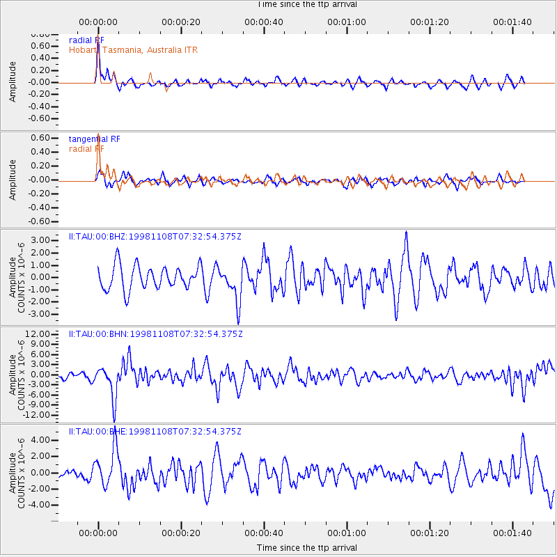
TAU Hobart, Tasmania, Australia - Earthquake Result Viewer
*The percent match for this event was below the threshold and hence no stack was calculated.
| Earthquake location: |
Savu Sea |
| Earthquake latitude/longitude: |
-9.1/121.4 |
| Earthquake time(UTC): |
1998/11/08 (312) 07:25:48 GMT |
| Earthquake Depth: |
33 km |
| Earthquake Magnitude: |
6.0 MB, 5.9 MS, 6.4 UNKNOWN, 5.7 ME |
| Earthquake Catalog/Contributor: |
WHDF/NEIC |
|
| Network: |
II Global Seismograph Network (GSN - IRIS/IDA) |
| Station: |
TAU Hobart, Tasmania, Australia |
| Lat/Lon: |
42.91 S/147.32 E |
| Elevation: |
132 m |
|
| Distance: |
40.6 deg |
| Az: |
150.433 deg |
| Baz: |
318.454 deg |
| Ray Param: |
$rayparam |
*The percent match for this event was below the threshold and hence was not used in the summary stack. |
|
| Radial Match: |
78.2487 % |
| Radial Bump: |
382 |
| Transverse Match: |
65.0468 % |
| Transverse Bump: |
400 |
| SOD ConfigId: |
4480 |
| Insert Time: |
2010-03-02 00:37:46.566 +0000 |
| GWidth: |
2.5 |
| Max Bumps: |
400 |
| Tol: |
0.001 |
|
Signal To Noise
| Channel | StoN | STA | LTA |
| II:TAU:00:BHN:19981108T07:32:54.375Z | 6.544909 | 4.816849E-6 | 7.3596885E-7 |
| II:TAU:00:BHE:19981108T07:32:54.375Z | 4.8748646 | 2.4008573E-6 | 4.9249724E-7 |
| II:TAU:00:BHZ:19981108T07:32:54.375Z | 1.4913113 | 1.4218624E-6 | 9.53431E-7 |
| Arrivals |
| Ps | |
| PpPs | |
| PsPs/PpSs | |


