You are here: Home > Network List > II - Global Seismograph Network (GSN - IRIS/IDA) Stations List
> Station TAU Hobart, Tasmania, Australia > Earthquake Result Viewer
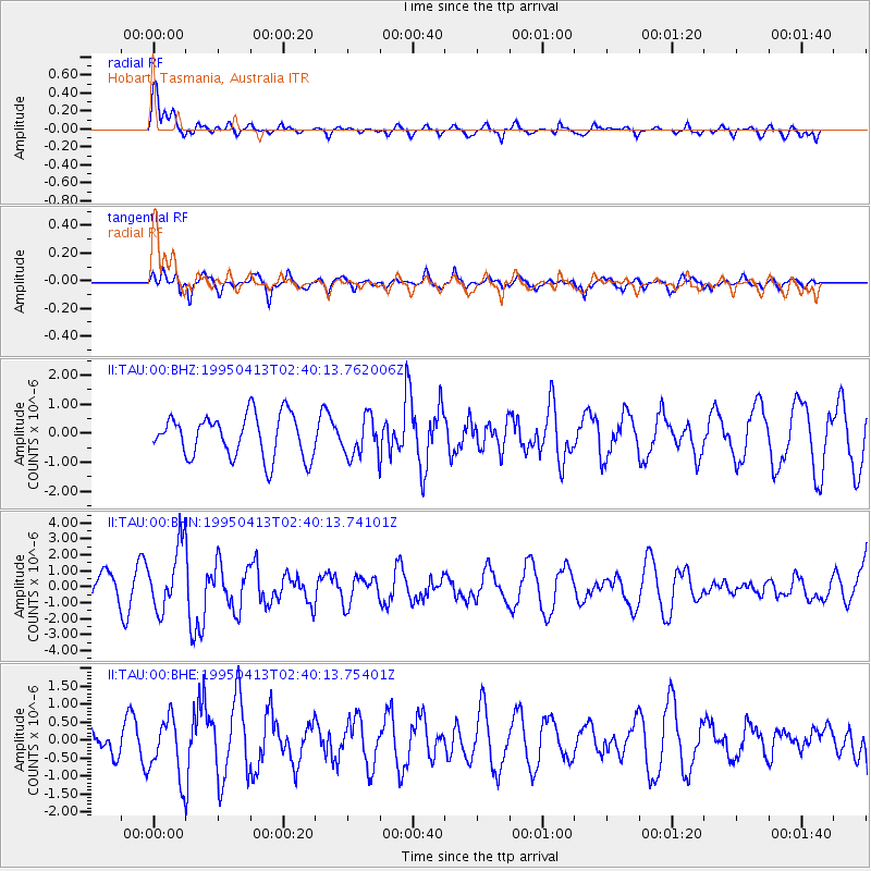
TAU Hobart, Tasmania, Australia - Earthquake Result Viewer
*The percent match for this event was below the threshold and hence no stack was calculated.
| Earthquake location: |
Vanuatu Islands Region |
| Earthquake latitude/longitude: |
-13.4/170.4 |
| Earthquake time(UTC): |
1995/04/13 (103) 02:34:38 GMT |
| Earthquake Depth: |
640 km |
| Earthquake Magnitude: |
5.5 MB, 5.6 UNKNOWN, 6.2 MW |
| Earthquake Catalog/Contributor: |
WHDF/NEIC |
|
| Network: |
II Global Seismograph Network (GSN - IRIS/IDA) |
| Station: |
TAU Hobart, Tasmania, Australia |
| Lat/Lon: |
42.91 S/147.32 E |
| Elevation: |
132 m |
|
| Distance: |
35.5 deg |
| Az: |
209.712 deg |
| Baz: |
41.034 deg |
| Ray Param: |
$rayparam |
*The percent match for this event was below the threshold and hence was not used in the summary stack. |
|
| Radial Match: |
67.79796 % |
| Radial Bump: |
378 |
| Transverse Match: |
58.480927 % |
| Transverse Bump: |
400 |
| SOD ConfigId: |
4480 |
| Insert Time: |
2010-03-02 00:38:14.495 +0000 |
| GWidth: |
2.5 |
| Max Bumps: |
400 |
| Tol: |
0.001 |
|
Signal To Noise
| Channel | StoN | STA | LTA |
| II:TAU:00:BHN:19950413T02:40:13.74101Z | 1.9116948 | 2.027316E-6 | 1.0604809E-6 |
| II:TAU:00:BHE:19950413T02:40:13.75401Z | 1.658553 | 8.314701E-7 | 5.0132263E-7 |
| II:TAU:00:BHZ:19950413T02:40:13.762006Z | 0.91599894 | 6.709057E-7 | 7.324307E-7 |
| Arrivals |
| Ps | |
| PpPs | |
| PsPs/PpSs | |


