You are here: Home > Network List > II - Global Seismograph Network (GSN - IRIS/IDA) Stations List
> Station TAU Hobart, Tasmania, Australia > Earthquake Result Viewer
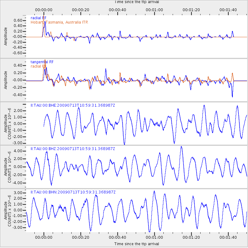
TAU Hobart, Tasmania, Australia - Earthquake Result Viewer
*The percent match for this event was below the threshold and hence no stack was calculated.
| Earthquake location: |
Sumba Region, Indonesia |
| Earthquake latitude/longitude: |
-9.1/119.3 |
| Earthquake time(UTC): |
2009/07/13 (194) 10:52:20 GMT |
| Earthquake Depth: |
67 km |
| Earthquake Magnitude: |
5.7 MB, 5.9 MW, 5.9 MW |
| Earthquake Catalog/Contributor: |
WHDF/NEIC |
|
| Network: |
II Global Seismograph Network (GSN - IRIS/IDA) |
| Station: |
TAU Hobart, Tasmania, Australia |
| Lat/Lon: |
42.91 S/147.32 E |
| Elevation: |
132 m |
|
| Distance: |
41.6 deg |
| Az: |
148.711 deg |
| Baz: |
315.73 deg |
| Ray Param: |
$rayparam |
*The percent match for this event was below the threshold and hence was not used in the summary stack. |
|
| Radial Match: |
69.80791 % |
| Radial Bump: |
398 |
| Transverse Match: |
64.70085 % |
| Transverse Bump: |
400 |
| SOD ConfigId: |
2648 |
| Insert Time: |
2010-03-02 00:38:15.884 +0000 |
| GWidth: |
2.5 |
| Max Bumps: |
400 |
| Tol: |
0.001 |
|
Signal To Noise
| Channel | StoN | STA | LTA |
| II:TAU:00:BHZ:20090713T10:59:31.368987Z | 1.5896237 | 2.7118642E-6 | 1.7059788E-6 |
| II:TAU:00:BHN:20090713T10:59:31.368987Z | 0.5722364 | 1.1176271E-6 | 1.9530862E-6 |
| II:TAU:00:BHE:20090713T10:59:31.368987Z | 0.5736249 | 7.280796E-7 | 1.2692608E-6 |
| Arrivals |
| Ps | |
| PpPs | |
| PsPs/PpSs | |


