You are here: Home > Network List > II - Global Seismograph Network (GSN - IRIS/IDA) Stations List
> Station TAU Hobart, Tasmania, Australia > Earthquake Result Viewer
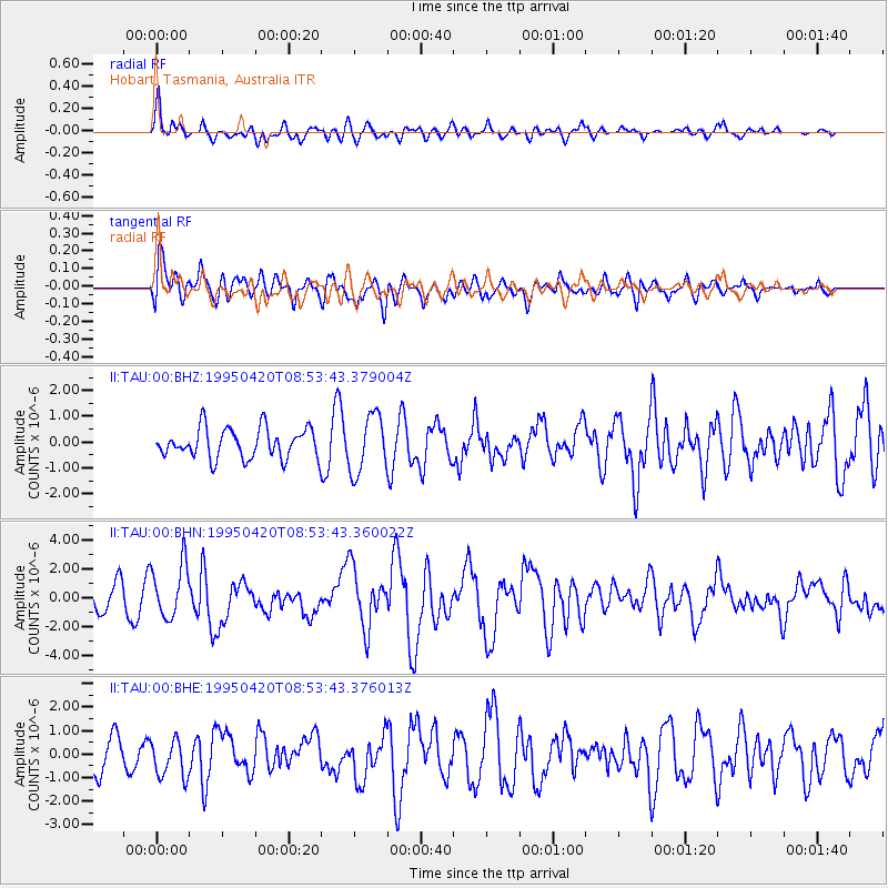
TAU Hobart, Tasmania, Australia - Earthquake Result Viewer
*The percent match for this event was below the threshold and hence no stack was calculated.
| Earthquake location: |
Mindanao, Philippines |
| Earthquake latitude/longitude: |
6.3/126.8 |
| Earthquake time(UTC): |
1995/04/20 (110) 08:45:10 GMT |
| Earthquake Depth: |
85 km |
| Earthquake Magnitude: |
6.2 MB, 6.6 UNKNOWN, 6.5 MW |
| Earthquake Catalog/Contributor: |
WHDF/NEIC |
|
| Network: |
II Global Seismograph Network (GSN - IRIS/IDA) |
| Station: |
TAU Hobart, Tasmania, Australia |
| Lat/Lon: |
42.91 S/147.32 E |
| Elevation: |
132 m |
|
| Distance: |
52.4 deg |
| Az: |
161.053 deg |
| Baz: |
333.94 deg |
| Ray Param: |
$rayparam |
*The percent match for this event was below the threshold and hence was not used in the summary stack. |
|
| Radial Match: |
61.83826 % |
| Radial Bump: |
400 |
| Transverse Match: |
69.16142 % |
| Transverse Bump: |
400 |
| SOD ConfigId: |
4480 |
| Insert Time: |
2010-03-02 00:38:16.597 +0000 |
| GWidth: |
2.5 |
| Max Bumps: |
400 |
| Tol: |
0.001 |
|
Signal To Noise
| Channel | StoN | STA | LTA |
| II:TAU:00:BHN:19950420T08:53:43.360022Z | 1.9707179 | 1.8621142E-6 | 9.448914E-7 |
| II:TAU:00:BHE:19950420T08:53:43.376013Z | 1.0922599 | 8.117219E-7 | 7.431583E-7 |
| II:TAU:00:BHZ:19950420T08:53:43.379004Z | 1.9379948 | 1.1140412E-6 | 5.748422E-7 |
| Arrivals |
| Ps | |
| PpPs | |
| PsPs/PpSs | |


