You are here: Home > Network List > TA - USArray Transportable Network (new EarthScope stations) Stations List
> Station Z41A Richland Creek Farm, El Dorado, AR, USA > Earthquake Result Viewer
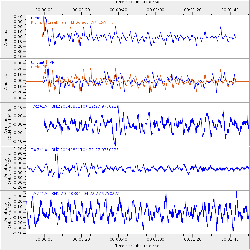
Z41A Richland Creek Farm, El Dorado, AR, USA - Earthquake Result Viewer
*The percent match for this event was below the threshold and hence no stack was calculated.
| Earthquake location: |
Northern Algeria |
| Earthquake latitude/longitude: |
36.9/3.2 |
| Earthquake time(UTC): |
2014/08/01 (213) 04:11:16 GMT |
| Earthquake Depth: |
10 km |
| Earthquake Magnitude: |
5.6 MWP |
| Earthquake Catalog/Contributor: |
NEIC PDE/NEIC COMCAT |
|
| Network: |
TA USArray Transportable Network (new EarthScope stations) |
| Station: |
Z41A Richland Creek Farm, El Dorado, AR, USA |
| Lat/Lon: |
33.26 N/92.80 W |
| Elevation: |
62 m |
|
| Distance: |
75.2 deg |
| Az: |
300.445 deg |
| Baz: |
55.62 deg |
| Ray Param: |
$rayparam |
*The percent match for this event was below the threshold and hence was not used in the summary stack. |
|
| Radial Match: |
72.26243 % |
| Radial Bump: |
400 |
| Transverse Match: |
73.6412 % |
| Transverse Bump: |
400 |
| SOD ConfigId: |
769524 |
| Insert Time: |
2014-08-15 05:16:29.630 +0000 |
| GWidth: |
2.5 |
| Max Bumps: |
400 |
| Tol: |
0.001 |
|
Signal To Noise
| Channel | StoN | STA | LTA |
| TA:Z41A: :BHZ:20140801T04:22:27.975022Z | 3.2708287 | 2.510704E-7 | 7.676048E-8 |
| TA:Z41A: :BHN:20140801T04:22:27.975022Z | 0.705527 | 9.5552615E-8 | 1.3543438E-7 |
| TA:Z41A: :BHE:20140801T04:22:27.975022Z | 1.4611206 | 1.336685E-7 | 9.148355E-8 |
| Arrivals |
| Ps | |
| PpPs | |
| PsPs/PpSs | |


