You are here: Home > Network List > II - Global Seismograph Network (GSN - IRIS/IDA) Stations List
> Station TAU Hobart, Tasmania, Australia > Earthquake Result Viewer
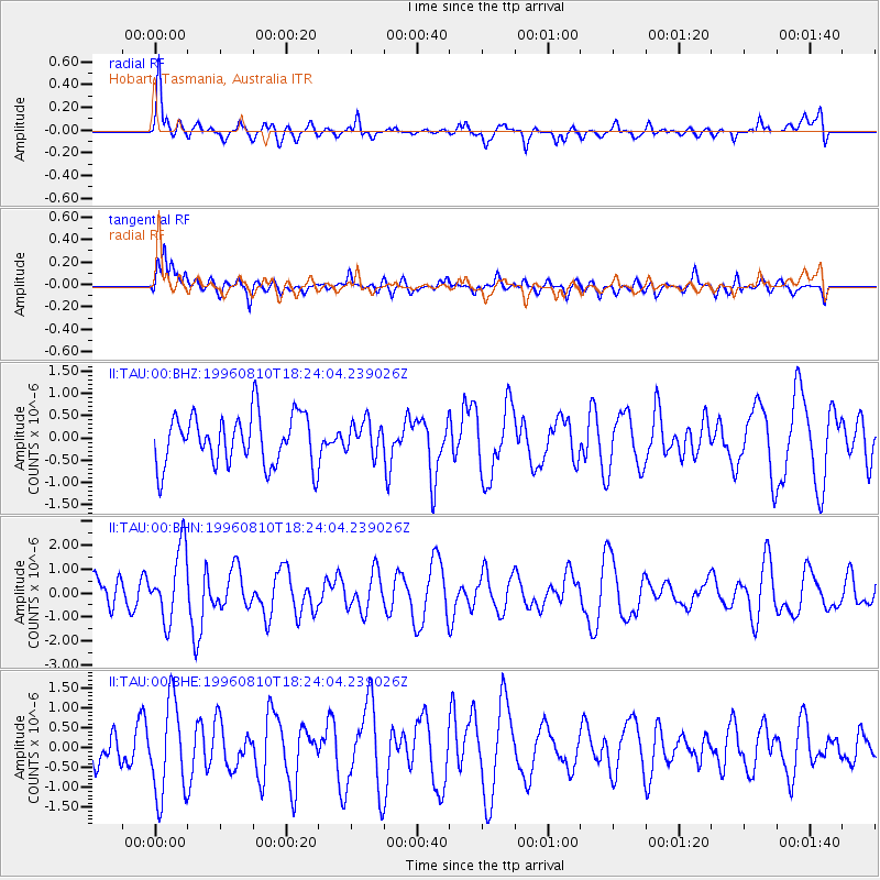
TAU Hobart, Tasmania, Australia - Earthquake Result Viewer
*The percent match for this event was below the threshold and hence no stack was calculated.
| Earthquake location: |
Eastern Honshu, Japan |
| Earthquake latitude/longitude: |
38.9/140.5 |
| Earthquake time(UTC): |
1996/08/10 (223) 18:12:17 GMT |
| Earthquake Depth: |
10 km |
| Earthquake Magnitude: |
6.0 MB, 5.7 MS, 5.9 UNKNOWN, 5.9 MW |
| Earthquake Catalog/Contributor: |
WHDF/NEIC |
|
| Network: |
II Global Seismograph Network (GSN - IRIS/IDA) |
| Station: |
TAU Hobart, Tasmania, Australia |
| Lat/Lon: |
42.91 S/147.32 E |
| Elevation: |
132 m |
|
| Distance: |
81.7 deg |
| Az: |
174.963 deg |
| Baz: |
354.65 deg |
| Ray Param: |
$rayparam |
*The percent match for this event was below the threshold and hence was not used in the summary stack. |
|
| Radial Match: |
70.10242 % |
| Radial Bump: |
400 |
| Transverse Match: |
61.725082 % |
| Transverse Bump: |
400 |
| SOD ConfigId: |
4480 |
| Insert Time: |
2010-03-02 00:38:42.817 +0000 |
| GWidth: |
2.5 |
| Max Bumps: |
400 |
| Tol: |
0.001 |
|
Signal To Noise
| Channel | StoN | STA | LTA |
| II:TAU:00:BHN:19960810T18:24:04.239026Z | 1.3736427 | 1.4877546E-6 | 1.0830724E-6 |
| II:TAU:00:BHE:19960810T18:24:04.239026Z | 1.9470613 | 1.1813664E-6 | 6.067433E-7 |
| II:TAU:00:BHZ:19960810T18:24:04.239026Z | 0.6343638 | 3.6288355E-7 | 5.7204335E-7 |
| Arrivals |
| Ps | |
| PpPs | |
| PsPs/PpSs | |


