You are here: Home > Network List > II - Global Seismograph Network (GSN - IRIS/IDA) Stations List
> Station TAU Hobart, Tasmania, Australia > Earthquake Result Viewer
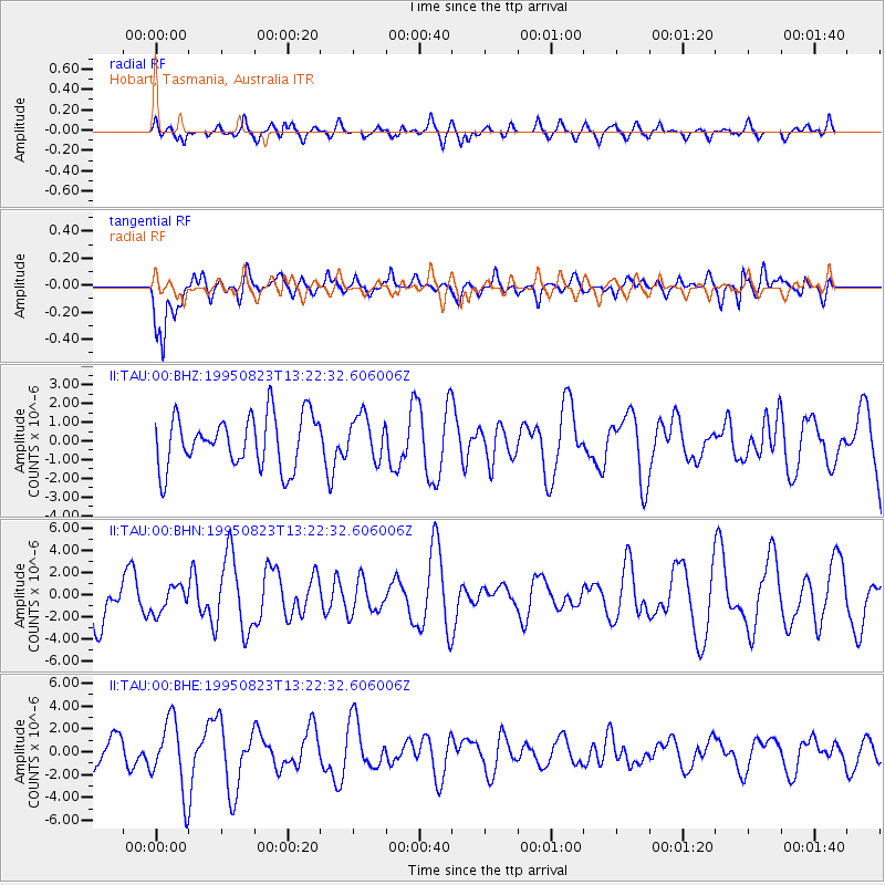
TAU Hobart, Tasmania, Australia - Earthquake Result Viewer
*The percent match for this event was below the threshold and hence no stack was calculated.
| Earthquake location: |
Pacific-Antarctic Ridge |
| Earthquake latitude/longitude: |
-56.8/-141.7 |
| Earthquake time(UTC): |
1995/08/23 (235) 13:14:42 GMT |
| Earthquake Depth: |
10 km |
| Earthquake Magnitude: |
5.9 MB, 5.6 MS, 5.5 UNKNOWN, 6.2 MW |
| Earthquake Catalog/Contributor: |
WHDF/NEIC |
|
| Network: |
II Global Seismograph Network (GSN - IRIS/IDA) |
| Station: |
TAU Hobart, Tasmania, Australia |
| Lat/Lon: |
42.91 S/147.32 E |
| Elevation: |
132 m |
|
| Distance: |
45.7 deg |
| Az: |
255.93 deg |
| Baz: |
133.342 deg |
| Ray Param: |
$rayparam |
*The percent match for this event was below the threshold and hence was not used in the summary stack. |
|
| Radial Match: |
46.739983 % |
| Radial Bump: |
400 |
| Transverse Match: |
69.73908 % |
| Transverse Bump: |
400 |
| SOD ConfigId: |
4480 |
| Insert Time: |
2010-03-02 00:38:55.730 +0000 |
| GWidth: |
2.5 |
| Max Bumps: |
400 |
| Tol: |
0.001 |
|
Signal To Noise
| Channel | StoN | STA | LTA |
| II:TAU:00:BHN:19950823T13:22:32.606006Z | 0.59457827 | 1.1652604E-6 | 1.95981E-6 |
| II:TAU:00:BHE:19950823T13:22:32.606006Z | 2.1543193 | 3.1622587E-6 | 1.4678691E-6 |
| II:TAU:00:BHZ:19950823T13:22:32.606006Z | 0.83513415 | 1.1610948E-6 | 1.3903094E-6 |
| Arrivals |
| Ps | |
| PpPs | |
| PsPs/PpSs | |


