GAMB Gambell Broadband - Earthquake Result Viewer
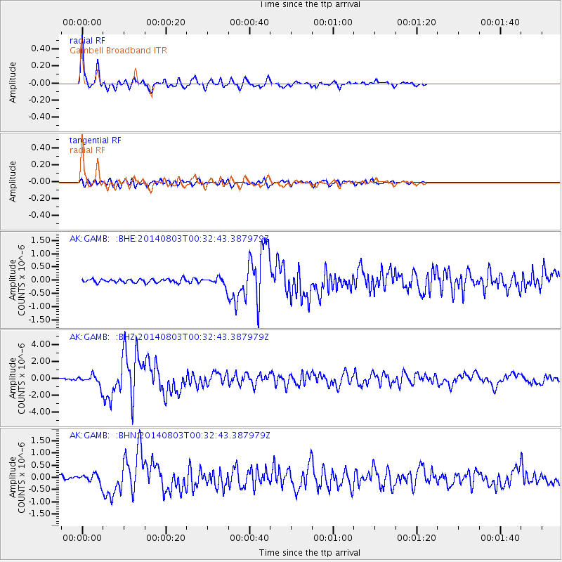
Earthquake location: E. Caroline Islands, Micronesia
Earthquake latitude/longitude: 0.8/146.1
Earthquake time(UTC): 2014/08/03 (215) 00:22:03 GMT
Earthquake Depth: 11 km
Earthquake Magnitude: 6.9 MWW, 6.8 MWB, 6.9 MWC, 7.2 MI
Earthquake Catalog/Contributor: NEIC PDE/NEIC COMCAT
Network: AK Alaska Regional Network
Station: GAMB Gambell Broadband
Lat/Lon: 63.78 N/171.70 W
Elevation: 10 m
Distance: 70.0 deg
Az: 18.502 deg
Baz: 225.581 deg
Ray Param: 0.05528829
Estimated Moho Depth: 29.25 km
Estimated Crust Vp/Vs: 1.80
Assumed Crust Vp: 6.24 km/s
Estimated Crust Vs: 3.471 km/s
Estimated Crust Poisson's Ratio: 0.28
Radial Match: 94.76428 %
Radial Bump: 305
Transverse Match: 77.11343 %
Transverse Bump: 400
SOD ConfigId: 769524
Insert Time: 2014-08-17 00:34:59.968 +0000
GWidth: 2.5
Max Bumps: 400
Tol: 0.001

Signal To Noise

ChannelStoNSTALTA
AK:GAMB: :BHZ:20140803T00:32:43.387979Z5.93113046.1853484E-71.04286165E-7
AK:GAMB: :BHN:20140803T00:32:43.387979Z2.5069361.7929602E-77.1519985E-8
AK:GAMB: :BHE:20140803T00:32:43.387979Z2.48044631.6783927E-76.766495E-8
Arrivals
Ps3.9 SECOND
PpPs13 SECOND
PsPs/PpSs17 SECOND