You are here: Home > Network List > II - Global Seismograph Network (GSN - IRIS/IDA) Stations List
> Station TAU Hobart, Tasmania, Australia > Earthquake Result Viewer
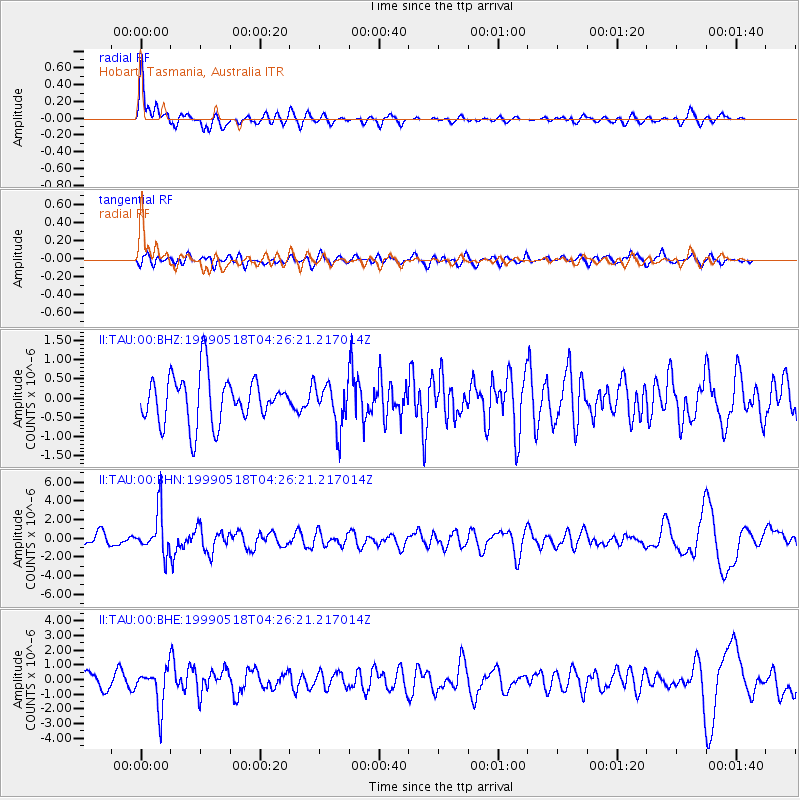
TAU Hobart, Tasmania, Australia - Earthquake Result Viewer
*The percent match for this event was below the threshold and hence no stack was calculated.
| Earthquake location: |
New Britain Region, P.N.G. |
| Earthquake latitude/longitude: |
-5.7/148.5 |
| Earthquake time(UTC): |
1999/05/18 (138) 04:19:53 GMT |
| Earthquake Depth: |
127 km |
| Earthquake Magnitude: |
5.5 MB |
| Earthquake Catalog/Contributor: |
WHDF/NEIC |
|
| Network: |
II Global Seismograph Network (GSN - IRIS/IDA) |
| Station: |
TAU Hobart, Tasmania, Australia |
| Lat/Lon: |
42.91 S/147.32 E |
| Elevation: |
132 m |
|
| Distance: |
37.1 deg |
| Az: |
181.476 deg |
| Baz: |
2.0 deg |
| Ray Param: |
$rayparam |
*The percent match for this event was below the threshold and hence was not used in the summary stack. |
|
| Radial Match: |
76.19716 % |
| Radial Bump: |
400 |
| Transverse Match: |
55.925312 % |
| Transverse Bump: |
400 |
| SOD ConfigId: |
4480 |
| Insert Time: |
2010-03-02 00:38:57.026 +0000 |
| GWidth: |
2.5 |
| Max Bumps: |
400 |
| Tol: |
0.001 |
|
Signal To Noise
| Channel | StoN | STA | LTA |
| II:TAU:00:BHN:19990518T04:26:21.217014Z | 3.6319466 | 2.3091727E-6 | 6.357948E-7 |
| II:TAU:00:BHE:19990518T04:26:21.217014Z | 2.4202657 | 1.3325285E-6 | 5.505712E-7 |
| II:TAU:00:BHZ:19990518T04:26:21.217014Z | 0.9362501 | 5.748914E-7 | 6.1403614E-7 |
| Arrivals |
| Ps | |
| PpPs | |
| PsPs/PpSs | |


