You are here: Home > Network List > TA - USArray Transportable Network (new EarthScope stations) Stations List
> Station Z41A Richland Creek Farm, El Dorado, AR, USA > Earthquake Result Viewer
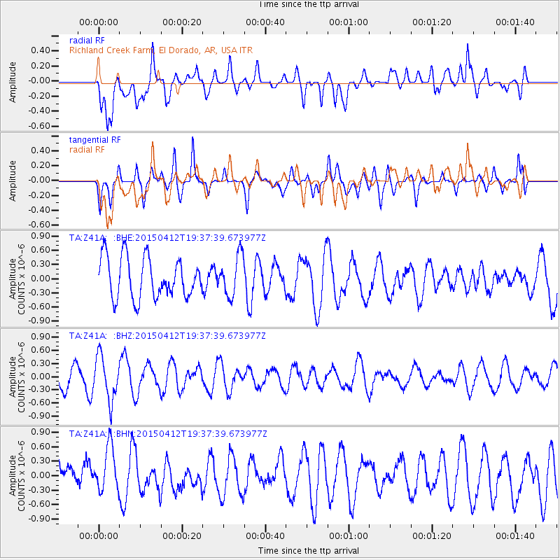
Z41A Richland Creek Farm, El Dorado, AR, USA - Earthquake Result Viewer
*The percent match for this event was below the threshold and hence no stack was calculated.
| Earthquake location: |
Off East Coast Of Honshu, Japan |
| Earthquake latitude/longitude: |
37.2/143.9 |
| Earthquake time(UTC): |
2015/04/12 (102) 19:25:01 GMT |
| Earthquake Depth: |
12 km |
| Earthquake Magnitude: |
5.2 MW, 5.7 mb, 4.8 MS |
| Earthquake Catalog/Contributor: |
ISC/ISC |
|
| Network: |
TA USArray Transportable Network (new EarthScope stations) |
| Station: |
Z41A Richland Creek Farm, El Dorado, AR, USA |
| Lat/Lon: |
33.26 N/92.80 W |
| Elevation: |
62 m |
|
| Distance: |
92.2 deg |
| Az: |
44.48 deg |
| Baz: |
318.11 deg |
| Ray Param: |
$rayparam |
*The percent match for this event was below the threshold and hence was not used in the summary stack. |
|
| Radial Match: |
56.051147 % |
| Radial Bump: |
400 |
| Transverse Match: |
44.63875 % |
| Transverse Bump: |
400 |
| SOD ConfigId: |
7422571 |
| Insert Time: |
2019-04-18 04:11:29.622 +0000 |
| GWidth: |
2.5 |
| Max Bumps: |
400 |
| Tol: |
0.001 |
|
Signal To Noise
| Channel | StoN | STA | LTA |
| TA:Z41A: :BHZ:20150412T19:37:39.673977Z | 1.9422811 | 5.1012137E-7 | 2.6264033E-7 |
| TA:Z41A: :BHN:20150412T19:37:39.673977Z | 1.3508564 | 4.89415E-7 | 3.622998E-7 |
| TA:Z41A: :BHE:20150412T19:37:39.673977Z | 1.0242212 | 4.3969368E-7 | 4.2929562E-7 |
| Arrivals |
| Ps | |
| PpPs | |
| PsPs/PpSs | |


