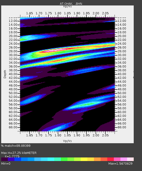
OHAK Old Harbor, Alaska - Earthquake Result Viewer

Earthquake location: E. Caroline Islands, Micronesia
Earthquake latitude/longitude: 0.8/146.1
Earthquake time(UTC): 2014/08/03 (215) 00:22:03 GMT
Earthquake Depth: 11 km
Earthquake Magnitude: 6.9 MWW, 6.8 MWB, 6.9 MWC, 7.2 MI
Earthquake Catalog/Contributor: NEIC PDE/NEIC COMCAT
Network: AT Alaska Tsunami Warning Seismic System
Station: OHAK Old Harbor, Alaska
Lat/Lon: 57.22 N/153.29 W
Elevation: 78 m
Distance: 73.8 deg
Az: 29.565 deg
Baz: 245.095 deg
Ray Param: 0.05278319
Estimated Moho Depth: 27.25 km
Estimated Crust Vp/Vs: 1.78
Assumed Crust Vp: 6.134 km/s
Estimated Crust Vs: 3.451 km/s
Estimated Crust Poisson's Ratio: 0.27
Radial Match: 89.89399 %
Radial Bump: 400
Transverse Match: 85.00808 %
Transverse Bump: 400
SOD ConfigId: 769524
Insert Time: 2014-08-17 00:39:27.378 +0000
GWidth: 2.5
Max Bumps: 400
Tol: 0.001

Signal To Noise

ChannelStoNSTALTA
AT:OHAK: :BHZ:20140803T00:33:06.100015Z5.2186037.2929976E-71.3975E-7
AT:OHAK: :BHN:20140803T00:33:06.100015Z1.68367033.8587586E-72.2918732E-7
AT:OHAK: :BHE:20140803T00:33:06.100015Z2.9792253.7498887E-71.2586793E-7
Arrivals
Ps3.6 SECOND
PpPs12 SECOND
PsPs/PpSs16 SECOND