
COCO West Island, Cocos (Keeling) Islands - Earthquake Result Viewer
| ||||||||||||||||||
| ||||||||||||||||||
| ||||||||||||||||||
|
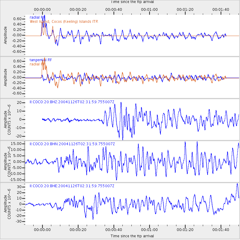
Signal To Noise
| Channel | StoN | STA | LTA |
| II:COCO:20:BHN:20041126T02:31:59.755007Z | 1.1893868 | 1.4343626E-6 | 1.205968E-6 |
| II:COCO:20:BHE:20041126T02:31:59.755007Z | 0.7850621 | 1.0445488E-6 | 1.3305302E-6 |
| II:COCO:20:BHZ:20041126T02:31:59.755007Z | 1.9882919 | 1.7942086E-6 | 9.0238694E-7 |
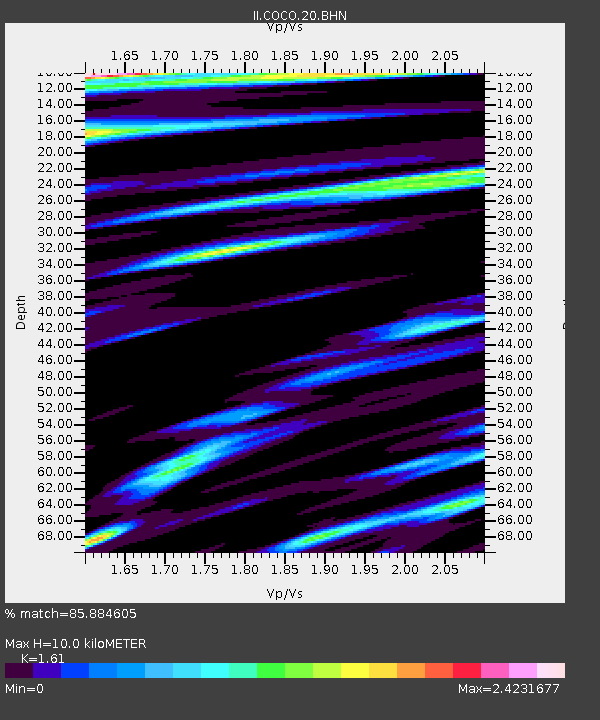
| Arrivals | |
| Ps | 1.5 SECOND |
| PpPs | 6.0 SECOND |
| PsPs/PpSs | 7.4 SECOND |

