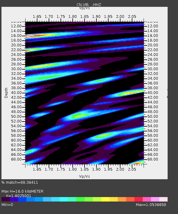
VIB VAN INLET, BC - Earthquake Result Viewer
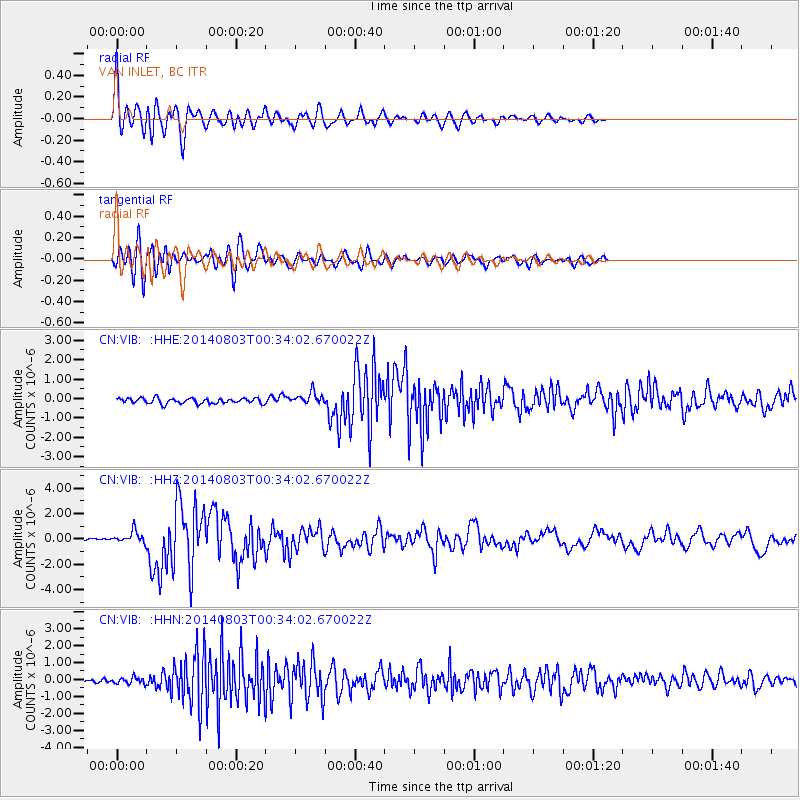
Earthquake location: E. Caroline Islands, Micronesia
Earthquake latitude/longitude: 0.8/146.1
Earthquake time(UTC): 2014/08/03 (215) 00:22:03 GMT
Earthquake Depth: 11 km
Earthquake Magnitude: 6.9 MWW, 6.8 MWB, 6.9 MWC, 7.2 MI
Earthquake Catalog/Contributor: NEIC PDE/NEIC COMCAT
Network: CN Canadian National Seismograph Network
Station: VIB VAN INLET, BC
Lat/Lon: 53.25 N/132.54 W
Elevation: 1008 m
Distance: 84.1 deg
Az: 36.664 deg
Baz: 263.541 deg
Ray Param: 0.045703497
Estimated Moho Depth: 16.0 km
Estimated Crust Vp/Vs: 1.60
Assumed Crust Vp: 6.183 km/s
Estimated Crust Vs: 3.858 km/s
Estimated Crust Poisson's Ratio: 0.18
Radial Match: 88.36411 %
Radial Bump: 400
Transverse Match: 84.56557 %
Transverse Bump: 400
SOD ConfigId: 769524
Insert Time: 2014-08-17 00:48:04.162 +0000
GWidth: 2.5
Max Bumps: 400
Tol: 0.001

Signal To Noise

ChannelStoNSTALTA
CN:VIB: :HHZ:20140803T00:34:02.670022Z5.98554664.706932E-77.86383E-8
CN:VIB: :HHN:20140803T00:34:02.670022Z1.22822211.8658369E-71.5191362E-7
CN:VIB: :HHE:20140803T00:34:02.670022Z2.29548553.1213588E-71.3597815E-7
Arrivals
Ps1.6 SECOND
PpPs6.6 SECOND
PsPs/PpSs8.2 SECOND