You are here: Home > Network List > TA - USArray Transportable Network (new EarthScope stations) Stations List
> Station Z41A Richland Creek Farm, El Dorado, AR, USA > Earthquake Result Viewer
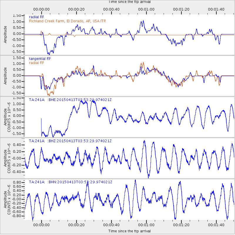
Z41A Richland Creek Farm, El Dorado, AR, USA - Earthquake Result Viewer
*The percent match for this event was below the threshold and hence no stack was calculated.
| Earthquake location: |
South Of Tonga Islands |
| Earthquake latitude/longitude: |
-25.2/-175.9 |
| Earthquake time(UTC): |
2015/04/13 (103) 03:40:28 GMT |
| Earthquake Depth: |
35 km |
| Earthquake Magnitude: |
4.4 mb, 4.1 mb |
| Earthquake Catalog/Contributor: |
ISC/ISC |
|
| Network: |
TA USArray Transportable Network (new EarthScope stations) |
| Station: |
Z41A Richland Creek Farm, El Dorado, AR, USA |
| Lat/Lon: |
33.26 N/92.80 W |
| Elevation: |
62 m |
|
| Distance: |
98.0 deg |
| Az: |
57.145 deg |
| Baz: |
245.292 deg |
| Ray Param: |
$rayparam |
*The percent match for this event was below the threshold and hence was not used in the summary stack. |
|
| Radial Match: |
43.11419 % |
| Radial Bump: |
400 |
| Transverse Match: |
40.122814 % |
| Transverse Bump: |
400 |
| SOD ConfigId: |
7422571 |
| Insert Time: |
2019-04-18 04:18:43.440 +0000 |
| GWidth: |
2.5 |
| Max Bumps: |
400 |
| Tol: |
0.001 |
|
Signal To Noise
| Channel | StoN | STA | LTA |
| TA:Z41A: :BHZ:20150413T03:53:29.974021Z | 0.7058305 | 1.2377863E-7 | 1.7536594E-7 |
| TA:Z41A: :BHN:20150413T03:53:29.974021Z | 1.0654918 | 4.4980476E-7 | 4.2215694E-7 |
| TA:Z41A: :BHE:20150413T03:53:29.974021Z | 1.2764498 | 1.3181076E-6 | 1.0326357E-6 |
| Arrivals |
| Ps | |
| PpPs | |
| PsPs/PpSs | |


