You are here: Home > Network List > US - United States National Seismic Network Stations List
> Station ELK Elko, Nevada, USA > Earthquake Result Viewer
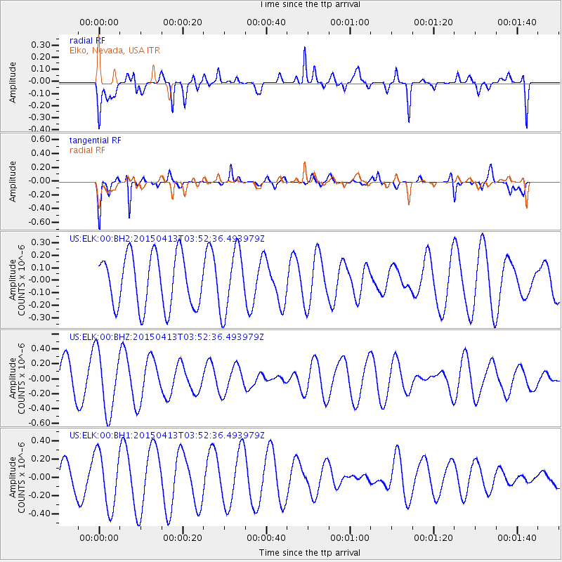
ELK Elko, Nevada, USA - Earthquake Result Viewer
*The percent match for this event was below the threshold and hence no stack was calculated.
| Earthquake location: |
South Of Tonga Islands |
| Earthquake latitude/longitude: |
-25.2/-175.9 |
| Earthquake time(UTC): |
2015/04/13 (103) 03:40:28 GMT |
| Earthquake Depth: |
35 km |
| Earthquake Magnitude: |
4.4 mb, 4.1 mb |
| Earthquake Catalog/Contributor: |
ISC/ISC |
|
| Network: |
US United States National Seismic Network |
| Station: |
ELK Elko, Nevada, USA |
| Lat/Lon: |
40.74 N/115.24 W |
| Elevation: |
2210 m |
|
| Distance: |
86.4 deg |
| Az: |
41.576 deg |
| Baz: |
232.319 deg |
| Ray Param: |
$rayparam |
*The percent match for this event was below the threshold and hence was not used in the summary stack. |
|
| Radial Match: |
52.737858 % |
| Radial Bump: |
400 |
| Transverse Match: |
87.39207 % |
| Transverse Bump: |
340 |
| SOD ConfigId: |
7422571 |
| Insert Time: |
2019-04-18 04:19:05.623 +0000 |
| GWidth: |
2.5 |
| Max Bumps: |
400 |
| Tol: |
0.001 |
|
Signal To Noise
| Channel | StoN | STA | LTA |
| US:ELK:00:BHZ:20150413T03:52:36.493979Z | 2.1822534 | 4.0441742E-7 | 1.8532101E-7 |
| US:ELK:00:BH1:20150413T03:52:36.493979Z | 2.0017989 | 3.0453398E-7 | 1.5213014E-7 |
| US:ELK:00:BH2:20150413T03:52:36.493979Z | 1.2063934 | 2.504881E-7 | 2.0763386E-7 |
| Arrivals |
| Ps | |
| PpPs | |
| PsPs/PpSs | |


