
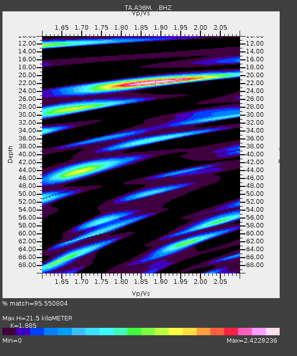
A36M Sachs Harbour, NT, CAN - Earthquake Result Viewer
| ||||||||||||||||||
| ||||||||||||||||||
| ||||||||||||||||||
|
Signal To Noise
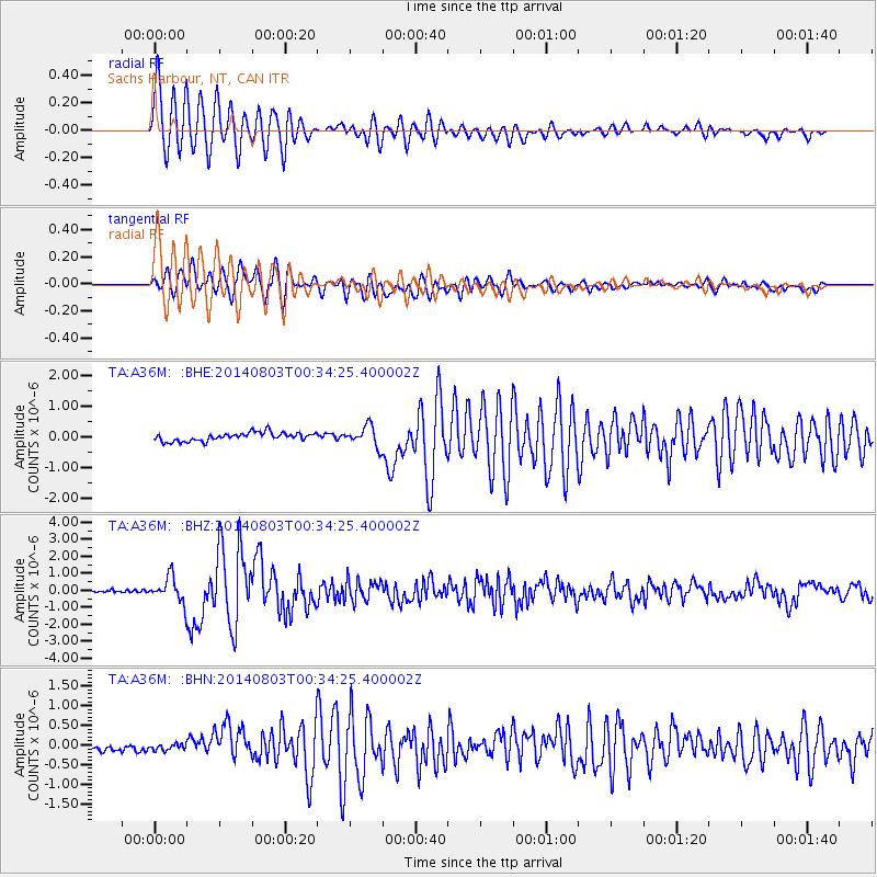
| Channel | StoN | STA | LTA |
| TA:A36M: :BHZ:20140803T00:34:25.400002Z | 10.707615 | 7.45714E-7 | 6.9643335E-8 |
| TA:A36M: :BHN:20140803T00:34:25.400002Z | 0.57844436 | 7.722276E-8 | 1.3350075E-7 |
| TA:A36M: :BHE:20140803T00:34:25.400002Z | 2.4421146 | 3.3063688E-7 | 1.3538958E-7 |
| Arrivals | |
| Ps | 3.1 SECOND |
| PpPs | 9.8 SECOND |
| PsPs/PpSs | 13 SECOND |

