You are here: Home > Network List > TA - USArray Transportable Network (new EarthScope stations) Stations List
> Station J01E Myrtle Point, OR, USA > Earthquake Result Viewer
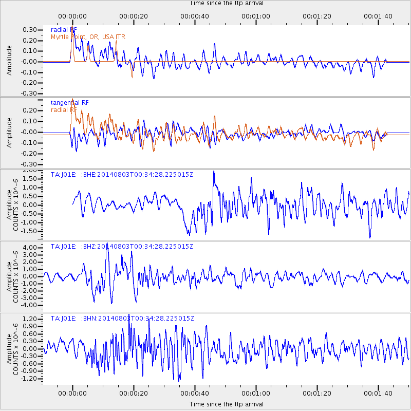
J01E Myrtle Point, OR, USA - Earthquake Result Viewer
*The percent match for this event was below the threshold and hence no stack was calculated.
| Earthquake location: |
E. Caroline Islands, Micronesia |
| Earthquake latitude/longitude: |
0.8/146.1 |
| Earthquake time(UTC): |
2014/08/03 (215) 00:22:03 GMT |
| Earthquake Depth: |
11 km |
| Earthquake Magnitude: |
6.9 MWW, 6.8 MWB, 6.9 MWC, 7.2 MI |
| Earthquake Catalog/Contributor: |
NEIC PDE/NEIC COMCAT |
|
| Network: |
TA USArray Transportable Network (new EarthScope stations) |
| Station: |
J01E Myrtle Point, OR, USA |
| Lat/Lon: |
43.16 N/123.93 W |
| Elevation: |
128 m |
|
| Distance: |
89.4 deg |
| Az: |
47.034 deg |
| Baz: |
270.562 deg |
| Ray Param: |
$rayparam |
*The percent match for this event was below the threshold and hence was not used in the summary stack. |
|
| Radial Match: |
69.1385 % |
| Radial Bump: |
400 |
| Transverse Match: |
67.116936 % |
| Transverse Bump: |
400 |
| SOD ConfigId: |
769524 |
| Insert Time: |
2014-08-17 00:59:42.875 +0000 |
| GWidth: |
2.5 |
| Max Bumps: |
400 |
| Tol: |
0.001 |
|
Signal To Noise
| Channel | StoN | STA | LTA |
| TA:J01E: :BHZ:20140803T00:34:28.225015Z | 2.0335107 | 7.1481367E-7 | 3.5151703E-7 |
| TA:J01E: :BHN:20140803T00:34:28.225015Z | 1.7434667 | 3.44726E-7 | 1.9772445E-7 |
| TA:J01E: :BHE:20140803T00:34:28.225015Z | 0.85004854 | 2.6753835E-7 | 3.1473303E-7 |
| Arrivals |
| Ps | |
| PpPs | |
| PsPs/PpSs | |


