K02D Willamette Meridian, OR, USA - Earthquake Result Viewer
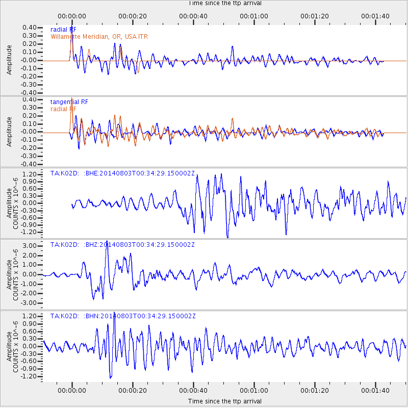
Earthquake location: E. Caroline Islands, Micronesia
Earthquake latitude/longitude: 0.8/146.1
Earthquake time(UTC): 2014/08/03 (215) 00:22:03 GMT
Earthquake Depth: 11 km
Earthquake Magnitude: 6.9 MWW, 6.8 MWB, 6.9 MWC, 7.2 MI
Earthquake Catalog/Contributor: NEIC PDE/NEIC COMCAT
Network: TA USArray Transportable Network (new EarthScope stations)
Station: K02D Willamette Meridian, OR, USA
Lat/Lon: 42.70 N/123.67 W
Elevation: 989 m
Distance: 89.6 deg
Az: 47.498 deg
Baz: 270.746 deg
Ray Param: 0.041750044
Estimated Moho Depth: 36.25 km
Estimated Crust Vp/Vs: 1.60
Assumed Crust Vp: 6.522 km/s
Estimated Crust Vs: 4.076 km/s
Estimated Crust Poisson's Ratio: 0.18
Radial Match: 87.63382 %
Radial Bump: 400
Transverse Match: 79.201485 %
Transverse Bump: 400
SOD ConfigId: 769524
Insert Time: 2014-08-17 00:59:51.679 +0000
GWidth: 2.5
Max Bumps: 400
Tol: 0.001

Signal To Noise

ChannelStoNSTALTA
TA:K02D: :BHZ:20140803T00:34:29.150002Z4.5051535.4142083E-71.2017811E-7
TA:K02D: :BHN:20140803T00:34:29.150002Z0.983110551.09252554E-71.1112947E-7
TA:K02D: :BHE:20140803T00:34:29.150002Z1.76186992.383164E-71.3526333E-7
Arrivals
Ps3.4 SECOND
PpPs14 SECOND
PsPs/PpSs18 SECOND