K04D Chiloquin, OR, USA - Earthquake Result Viewer
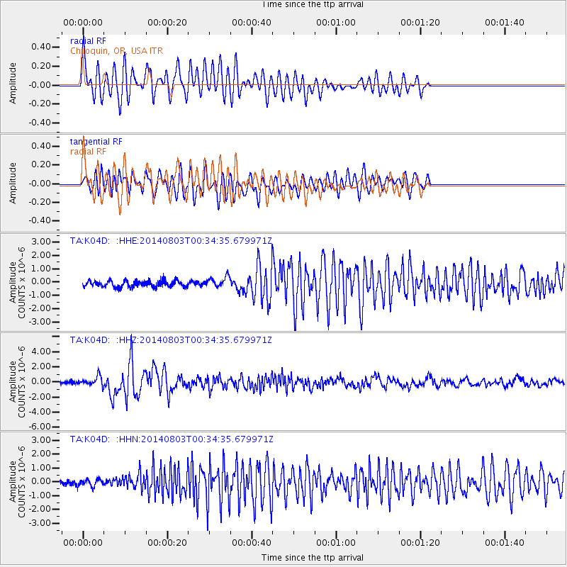
Earthquake location: E. Caroline Islands, Micronesia
Earthquake latitude/longitude: 0.8/146.1
Earthquake time(UTC): 2014/08/03 (215) 00:22:03 GMT
Earthquake Depth: 11 km
Earthquake Magnitude: 6.9 MWW, 6.8 MWB, 6.9 MWC, 7.2 MI
Earthquake Catalog/Contributor: NEIC PDE/NEIC COMCAT
Network: TA USArray Transportable Network (new EarthScope stations)
Station: K04D Chiloquin, OR, USA
Lat/Lon: 42.62 N/121.75 W
Elevation: 1315 m
Distance: 91.0 deg
Az: 47.534 deg
Baz: 272.037 deg
Ray Param: 0.04163423
Estimated Moho Depth: 51.75 km
Estimated Crust Vp/Vs: 1.93
Assumed Crust Vp: 6.597 km/s
Estimated Crust Vs: 3.41 km/s
Estimated Crust Poisson's Ratio: 0.32
Radial Match: 83.579544 %
Radial Bump: 400
Transverse Match: 76.6356 %
Transverse Bump: 400
SOD ConfigId: 769524
Insert Time: 2014-08-17 00:59:58.543 +0000
GWidth: 2.5
Max Bumps: 400
Tol: 0.001

Signal To Noise

ChannelStoNSTALTA
TA:K04D: :HHZ:20140803T00:34:35.679971Z3.01034386.425421E-72.1344475E-7
TA:K04D: :HHN:20140803T00:34:35.679971Z1.07724422.434112E-72.259573E-7
TA:K04D: :HHE:20140803T00:34:35.679971Z1.7182214.020932E-72.3401716E-7
Arrivals
Ps7.5 SECOND
PpPs23 SECOND
PsPs/PpSs30 SECOND