
O02D Mt. Diablo Meridian, CA, USA - Earthquake Result Viewer
| ||||||||||||||||||
| ||||||||||||||||||
| ||||||||||||||||||
|
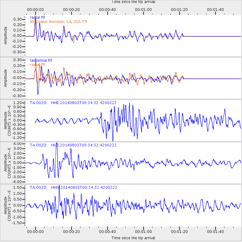
Signal To Noise
| Channel | StoN | STA | LTA |
| TA:O02D: :HHZ:20140803T00:34:32.420022Z | 5.191485 | 6.043363E-7 | 1.1640915E-7 |
| TA:O02D: :HHN:20140803T00:34:32.420022Z | 1.9443591 | 1.3759414E-7 | 7.076581E-8 |
| TA:O02D: :HHE:20140803T00:34:32.420022Z | 1.2538649 | 1.3883778E-7 | 1.1072786E-7 |
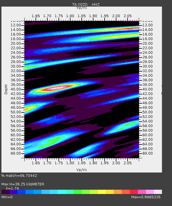
| Arrivals | |
| Ps | 4.5 SECOND |
| PpPs | 16 SECOND |
| PsPs/PpSs | 21 SECOND |

